
Chüebodenhorn
Information
| Date: | 18 August 2009 |
| Maximum height: | 3070 m |
| Difference in height: | 1350 m |
| Length: | 14 km |
| Kilometers effort: | 32 kmef |
| Duration: | 11 hours |
| Huts reached: | Vecchia Capanna Piansecco (sostituita nel 2020) |
| Rifugio Cassina Baggio (crollato) |
| Lakes reached: | Lago del Chüebodengletscher |
Difficulties

|
Dalla strada del passo fino al Rifugio Cassina Baggio. |

|
Dal Rifugio Cassina Baggio fino al Gerenpass. |

|
Dal Gerenpass fino in vetta. |
Comment (Automatic translation in english)
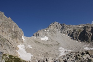
For this excursion you can start from All'Acqua or with less altitude but more kilometers from the road of the Passo della Novena at an altitude of 2099 meters. From here follow the path, not too flat, to the Piansecco hut and once you reach it you start to climb. First you reach the Cassina Baggio Refuge, a military construction that should now be open to everyone, even if we actually found it closed. Later the path, which until now was clearly visible, becomes a trace. Following it you finally arrive at the Gerenpass from where you can admire the glacier with its lake. At this point the path disappears altogether and only a few small men remain. From step up to the top is a stony ground with medium-large boulders, physically demanding, but not too difficult.
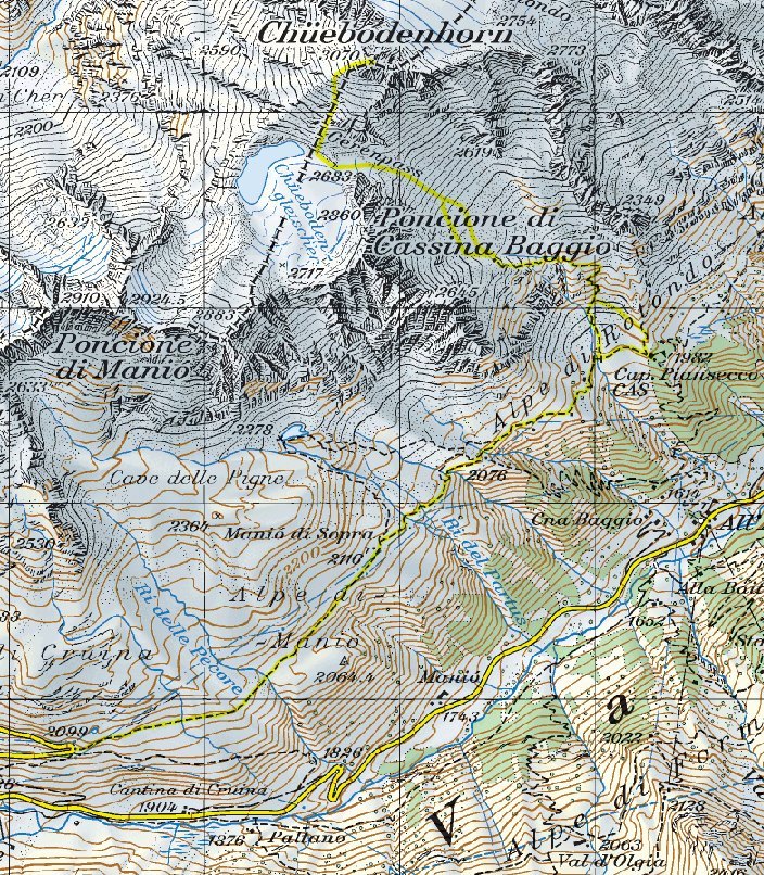
Map of the Path


Comments (0)