
Cima dell'Uomo
Information
| Date: | 26 June 2008 |
| Maximum height: | 2390 m |
| Difference in height: | 1400 m |
| Length: | 13 km |
| Kilometers effort: | 31.7 kmef |
| Duration: | 9 hours |
| Huts reached: | Capanna Albagno |
Difficulties

|
Da Bedretto fino all'Alpe di Arami. |

|
Dall'Alpe di Arami fino alla Capanna Albagno. |

|
Dalla Capanna fino alla Bocchetta d'Erbea. |

|
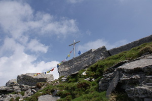
Dalla Bocchetta fino alla Cima dell'Uomo. |
Comment (Automatic translation in english)
To get to the Albagno hut you can start from Bedretto where there is a large car park or go up with the cable car to Mornera. From Bedretto then follow the path that runs along the Valle di Gorduno until you reach the hut. From here go up first towards the bocchetta d'Albagno and then deviate to the Erbea bocchetta. Once reached, descend for about 60 meters on the other side and then go up again to the Cima dell'Uomo outlet. From the latter you can quickly reach the top of the same name passing by a small passage not too difficult for 1°+. For the return you can follow the same itinerary.
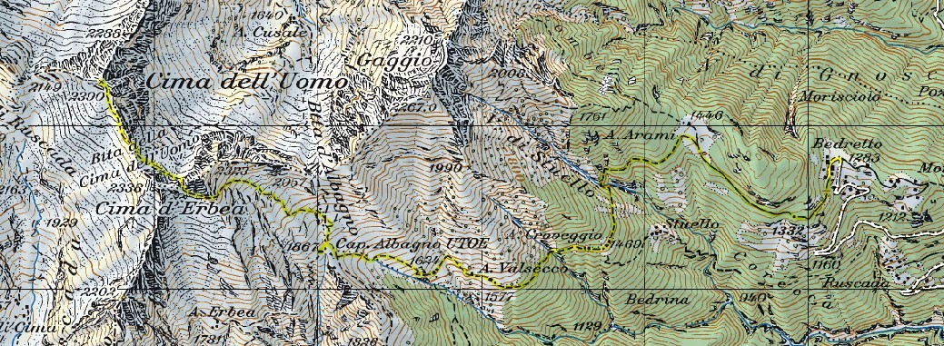
Map of the Path


Comments (0)