
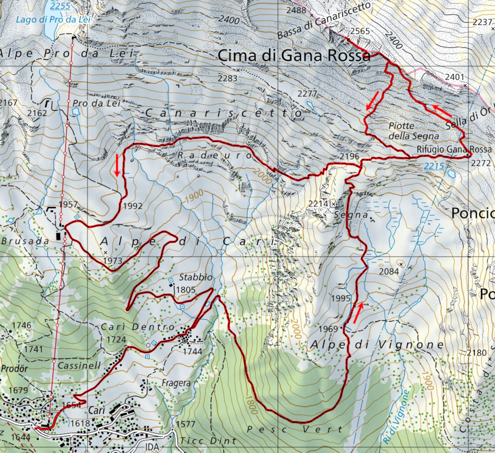
Cima di Gana Rossa
Information
| Date: | 6 October 2022 |
| Maximum height: | 2565 m |
| Difference in height: | 960 m |
| Length: | 13 km |
| Kilometers effort: | 25.8 kmef |
| Duration: | 6 hours |
| Huts reached: | Rifugio Gana Rossa |
Difficulties (Automatic translation in english)

|
From Carì to the Rifugio Gana Rossa via the Alpe di Vignone (T1 the road section). |

|
From the Rifugio Gana Rossa to an altitude of 2500 metres (with some T3 passages). |

|
From an altitude of 2500 metres to the summit. |
|
|
From an altitude of 2500 metres to the path coming from Alpe Pro da Lei (with a few T3 passages). |
|
|
The descent to Carì via Brusada (T1 the road section). |
Comment (Automatic translation in english)
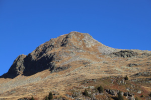
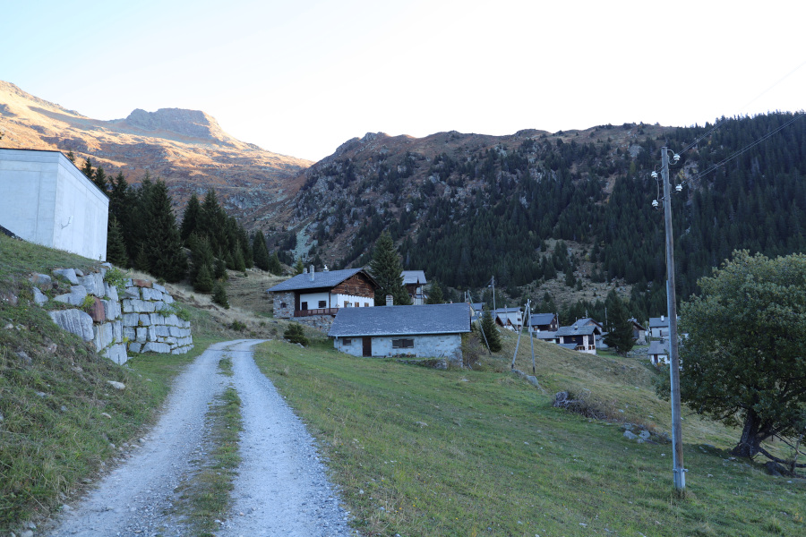
Today's excursion is to the Cima di Gana Rossa, between the Leventina Valley and the Blenio Valley. The easiest way to reach it is to start from the village of Carì, where there are many free parking spaces.
I then start walking along the dirt road that goes up to Carì di Dentro, after which I follow the path that goes up to the Alpe di Vignone and continues to the Gana Rossa hut. I then continue to climb for a little while more towards the Sella di Ör Languosa and then, after about 100 metres, I leave the track and head north-west. The terrain is not difficult and between the rocks there is almost always a strip of grass to walk on. At around 2450 metres, I reach the ridge and follow it up to an altitude of 2500 metres, after which I cross the slope to the west until I reach a sort of ledge that rises above some rocks. This is perhaps the trickiest point of the entire outing, as the slope is quite steep, but once past it you reach the south side of the mountain where a slight track rises in the middle of the meadow. The slope is still quite steep and sometimes you have to climb holding onto the tufts of grass. I finally reach the summit ridge, which I walk along for about a hundred metres to the exact spot, marked by a large stone cairn, where the summit is located.
After resting for an hour or so, I start to descend again by the same route as on the way up to an altitude of 2500 metres. At that point, since I am no longer interested in passing by the Gana Rossa refuge, I cut directly south to return to the path coming from Alpe Pro da Lei. I then return again to the crossroads at an altitude of 2196 metres and this time, to change the route, I decide to descend to Brusada. Once reached, I follow the road back to Carì where I conclude this excursion.
With regard to water, I found the only working fountain at Cassinello. The others were closed, probably because winter is approaching.
Map of the Path


")


")

")


")


Comments (0)