
Föisc
Information
| Date: | 21 September 2019 |
| Maximum height: | 2208 m |
| Difference in height: | 400 m |
| Length: | 5.5 km |
| Kilometers effort: | 10.8 kmef |
| Duration: | 3 hours |
| Huts reached: | Rifugio Föisc |
Difficulties

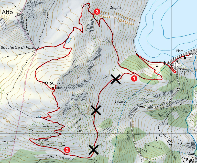
|
Dalla diga del Ritom fino al punto 1. |

|
Dal punto 1 al punto 2 (sentiero scomparso). |
|
|
Dal punto 2 fino in cima al Föisc e da lì fino alla diga del Ritom (con passaggi T3 tra quota 2050 e quota 1980 metri, vicino al punto 3). |
Comment (Automatic translation in english)
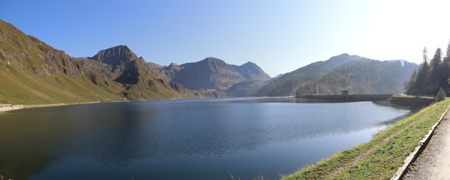
For this trip we reach the Ritom dam where there is a parking fee (7 or 8 Fr. for 3 hours, 11 Fr. for 6 hours and 15 Fr. for the whole day). Unfortunately, in this period about half of all parking spaces are occupied by the construction site for the construction of the new hydroelectric plant. However, there are still about thirty left. The works will last from 2019 to 2021. According to what has been read on the internet there should have been a traffic light at Altanca that allowed the transit towards Piora only when the parking under the dam was free, but for now no trace.
Alternatively, there is always the Piotta-Ritom funicular that reaches the road about 1 km before Piora.
From the dam you begin to follow the road that leads to Cadagno and after about 200 meters you reach a path that goes up on the left. We follow this path up to the altitude of 1930 meters (point 1) where there is a crossroads. Here we decide to take the "path" that on the map is marked to the left and that goes south. Unfortunately, we soon discover that this "path" no longer exists. It has almost disappeared completely and in many places you risk slipping. I therefore advise against following it.
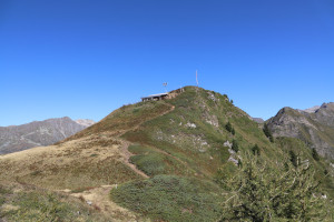
When we reach the altitude of 2030 meters (point 2), after much effort, we meet the path that comes from the cable car and finally return on beaten paths. We continue to climb through many avalanche shelters and after a short time we reach the top of Föisc. Here the view is wonderful and allows us to observe the entire area of Ritom as well as the entire Leventina Valley. A few meters below the summit there is also the Föisc refuge, a small building that can accommodate up to 8 people.
For the return we decide to go down north and in a short time we reach a small lake at an altitude of 2100 meters. From here we make a quick detour to the Bocchetta di Föisc and then we return to the lake and begin to descend towards the Ritom. Between the altitude of 2050 meters and the altitude of 1980 meters (near point 3) the path becomes steeper and more ruined and we must therefore be careful when walking along it. Still a hundred meters of difference in height and we are finally at the dam and parking lot.
As for the water, along the way there is none and you must therefore remember to take enough with you.
Map of the Path


Comments (0)