
Gridone o Ghiridone
Information
| Date: | 18 June 2009 |
| Maximum height: | 2188.1 m |
| Difference in height: | 1200 m |
| Length: | 9 km |
| Kilometers effort: | 25 kmef |
| Duration: | 6 hours |
| Huts reached: | Capanna Al Legn |
Difficulties (Automatic translation in english)

|
From Mergugno to Bocchetta di Valle. |

|
From Bocchetta di Valle to the top of Gridone. |
Comment (Automatic translation in english)
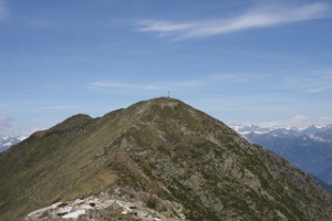
To get to the Gridone there are many ways, the one I took part from Mergugno, above Brissago. The first 400 meters of difference in height meander through a forest called Bosco Sacro. It has the distinction of being full of alpine labyrinths, among the most beautiful in the entire Alpine area. In fact, there are many specimens whose trunk exceeds 20 cm in diameter. Continuing the climb you exit the forest and continue among various shrubs, including the Rosa Canina, and finally arrive at the Al Legn hut. From here continue to the Bocchetta di Valle. At this point you can take the right path, more direct but also with 2 passes that overcome the difficulty T3, or the left path along the border, less direct but easier. Once you reach the base of the Gridone, there are only 60 meters of difference in height and you are at the top. For the return, follow the same route as the outward journey.
Water (Automatic translation in english)
There is a fountain near the car park in Mergugno and then one at the Capanna Al Legn.
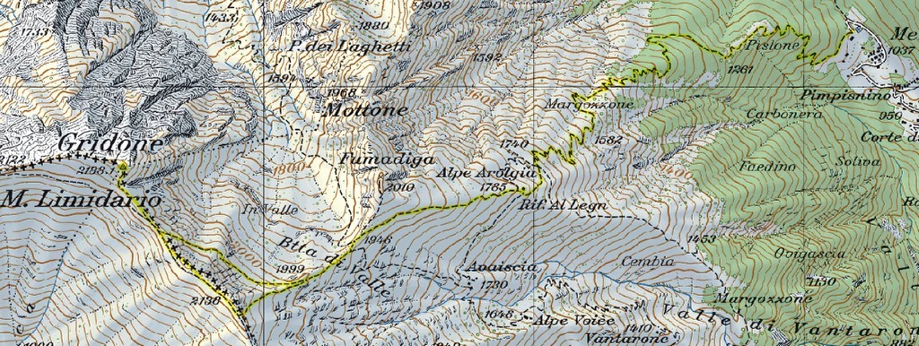
Map of the Path

Summits
Huts


Comments (0)