
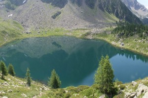
Lago di Mognòla e Acquedotto di Canà
Information
| Date: | 6 July 2011 |
| Maximum height: | 2079 m |
| Difference in height: | 700 m |
| Length: | 7 km |
| Kilometers effort: | 16.3 kmef |
| Duration: | 5 hours |
| Lakes reached: | Lago di Mognòla |
Difficulties

|
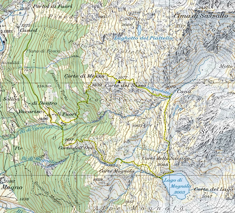
Da Portol di Fuori fino a Vacarisc. |

|
Da Vacarisc fino al Lago di Mognòla e ritorno passando dall'Acquedotto di Canà. |
Comment (Automatic translation in english)
Leave the car on the road to Vacarisc (prohibition sign), then continue to this last location. From here starts an educational trail that performs the same loop tour followed by me and that, at each stage, illustrates the area reached with descriptive signs. First you go up to the Corte dell'Ovi. From here you reach the Corte Mognòla where there is a farmhouse turned into a small museum and can be visited freely. Then continue until the Lake of Mognòla and from here you reach the area of Canà. In this location the aqueduct starts, which collects part of the water coming from the overhanging natural amphitheater, sending it to the Corte del Sasso, along a very beautiful and spectacular half-kilometer route. You can follow it entirely and finally descend to Vacarisc along a path just as steep as that of the outward journey.
Map of the Path


Comments (0)