
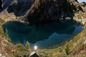
Lago del Pèzz
Information
| Date: | 2 October 2011 |
| Maximum height: | 1979 m |
| Difference in height: | 1050 m |
| Length: | 8 km |
| Kilometers effort: | 22 kmef |
| Duration: | 6 hours |
| Lakes reached: | Lago del Pèzz |
Difficulties

|
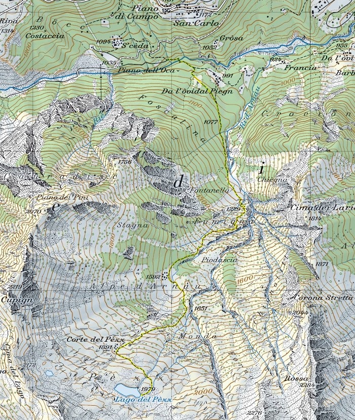
Dal ponte sul fiume Rovana fino all'Alpe d'Arnau |

|
Dall'Alpe d'Arnau fino al Lago del Pèzz |
Comment (Automatic translation in english)
Just before San Carlo a road descends to the river, where you can leave the car. Cross the bridge over the Rovana and start climbing towards Fümigna. Reached this area the path begins to rise seriously and you arrive in a short time at Alpe d'Arnau, where there is a nice nucleus with many farms. We continue along a path a little 'less beautiful than the previous one and so we come to a second nucleus, the Corte del Pèzz. From here in a very short time you reach the lake that bears the same name, a beautiful body of water of a very intense blue, which I rarely see. After the due siesta, it goes back down the same way. Water is present in many places. There are 2 fountains with tap at Alpe d'Arnau and another at Corte del Pèzz. Then there is a stream at an altitude of 1229 meters, another one to the east of the lake and finally, of course, the water of the lake itself.
Map of the Path


Comments (2)
È una bella esperienza tuttavia