
Lago dei Pozzöi e Lago Gelato
Information
| Date: | 9 July 2021 |
| Maximum height: | 2169 m |
| Difference in height: | 1080 m |
| Length: | 16 km |
| Kilometers effort: | 30.4 kmef |
| Duration: | 6 hours |
| Lakes reached: | Lago dei Pozzöi |
| Lago Gelato |
Difficulties (Automatic translation in english)

|
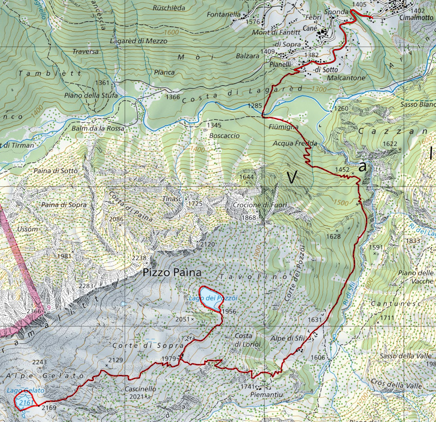
From Cimalmotto to the end of the road in Pianelli di Sotto. |

|
From Pianelli di Sotto to Alpe di Sfii. |

|
From Alpe di Sfii to Lago dei Pozzöi and Lago Gelato. |
Comment (Automatic translation in english)
After having been to Lago di Sfii last year, this year I return to the area to do two more lakes: Lago dei Pozzöi and Lago Gelato.
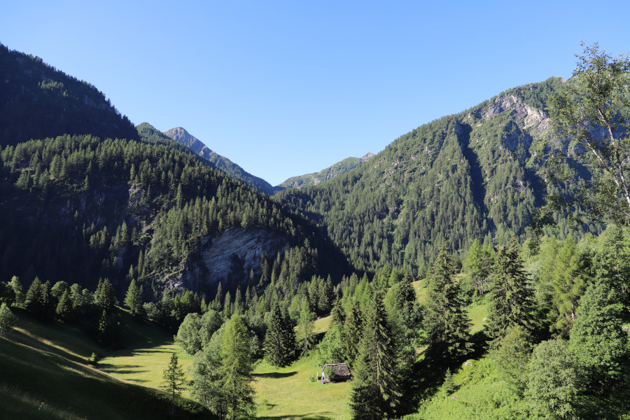
First of all I reach the village of Cimalmotto, in Valle di Campo, where I park my car. I then start walking along the road (with no traffic allowed) that goes down to Pianelli di Sotto. When I reach Pianelli di Sotto, I take the path that continues to the Rovana river and then start to climb on the opposite side of the valley. The route has a fair gradient up to an altitude of 1500 metres, after which it becomes a little flatter. When I reach the Alpe di Sfii, the path begins to climb again and I soon reach Corte di Sopra. At this point, I turn right and, after a flat stretch followed by a slight descent, I reach Lago dei Pozzöi.
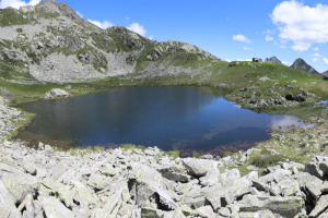
This small lake, surrounded by meadows and larches, is perhaps one of the most beautiful I have ever seen. I walk around the entire perimeter to take a few photos and then I leave in the direction of Corte di Sopra.
Back at the alp, I take the path that goes up to the Lago Gelato. After a hundred or so metres from the junction, I have to turn right and leave the big track that continues on the flat towards Cascinello. If you are not careful, it is easy to make a mistake and continue straight ahead. In the first few metres the track is not very visible, but as you climb it improves. Higher up, there are still a few points where the path fades a little, only to reappear shortly afterwards.
After climbing over one last bump, I finally arrive at Lago Gelato, located in a hollow almost on the edge of the sky. Here, too, I go around the lake to take some photos and, after a good break, I start the descent to Alpe di Sfii and Cimalmotto.
Speaking of water, there is a fountain near the road just after Cimalmotto and then another one at Corte di Sopra. There is also another stream at an altitude of around 1380 metres.
Map of the Path


Comments (0)