
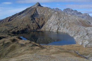
Lago Retico e Cima di Garina
Information
| Date: | 6 October 2006 |
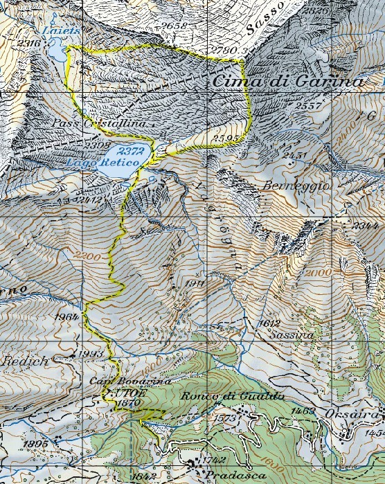
| Maximum height: | 2780.3 m |
| Difference in height: | 1200 m |
| Length: | 11 km |
| Kilometers effort: | 27 kmef |
| Duration: | 6 hours |
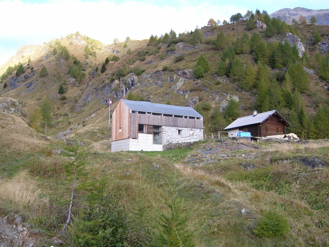
| Huts reached: | Capanna Bovarina |
| Lakes reached: | Lago Retico |
| Laghetto Laiets |
Difficulties

|
Dal posteggio fino al Lago Retico. |

|
Dal Lago Retico fino in vetta e poi fino a Laiets. |
|
|
Da Laiets fino al Lago Retico. |
Comment (Automatic translation in english)
The Retico lake is located in Valle di Campo, which can be reached from Olivone. You can leave your car near the Pradasca alp and from here continue on foot to the Capanna Bovarina. It then continues to climb along wide lawns until you reach the lake. From here I continued the tour following for a while the "path of the ibex" (not marked on the map, but well marked) even if you have not seen one of ibex. At one point I left the path and I reached the top. From here I continued in the territory of Graubünden until reaching the Laiets pond and then up the slope that leads to the Cristallina pass and return to the Retico lake. From here you will then return to the car.
Map of the Path


Comments (0)