
Pizzo Lucendro
Information
| Date: | 15 September 2005 |
| Maximum height: | 2962.7 m |
| Difference in height: | 900 m |
| Length: | 13 km |
| Kilometers effort: | 25 kmef |
| Duration: | 6 hours |
Difficulties

|
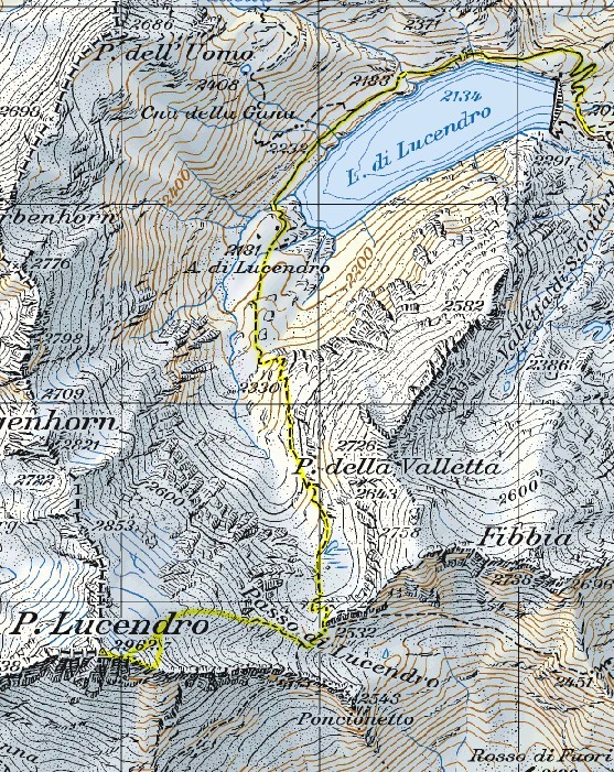
Dalla diga del Lucendro all'Alpe di Lucendro. |

|
Dall'Alpe di Lucendro fino al Passo di Lucendro. |

|
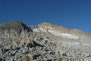
Dal Passo di Lucendro fino a 100 metri dalla vetta. |

|
Gli ultimi 100 metri prima della vetta. |
Comment (Automatic translation in english)
For this excursion you can leave the car under the Lucendro dam where there is a large open space.
You start walking along the asphalt road that after a few hundred meters becomes a dirt road. We walk along the whole lake until you get to the Lucendro Alp.
Here you continue along the well-marked path that goes up south to the Passo di Lucendro. Continue then going westwards along a moraine and turning slowly towards the south, head towards the antic situated to the east of the summit at an altitude of about 2920 meters.
Then follow the ridge up to the top where there is a station for meteorological surveys.
For the return we follow the same route of the journey.
Map of the Path


Comments (1)