
Monte San Salvatore
Information
| Date: | 5 December 2019 |
| Maximum height: | 913 m |
| Difference in height: | 300 m |
| Length: | 4 km |
| Kilometers effort: | 8 kmef |
| Duration: | 2 hours |
Difficulties

|
Lungo tutto il percorso. |
Comment (Automatic translation in english)
Today, since the day is a bit cold, I decide to take a light trip and climb Mount San Salvatore.
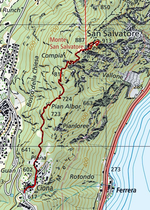
I leave from Ciona, a small village in the hamlet of Carona, where there is a large car park near the main road.
I then walk through the village centre along a fairly flat road heading north.
After about 500 metres this becomes a path and begins to climb more steeply.
The path is well maintained and well marked. Almost everything takes place in the woods with a few panoramic viewpoints, almost all towards the end.
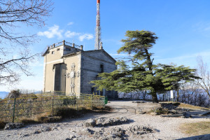
On the top of Monte San Salvatore there are several buildings, including a restaurant, a museum and finally the famous church dedicated to the saint of the same name. On the roof of the latter it is sometimes also possible to climb up. Unfortunately today, probably due to the closure of the restaurant and the funicular, the door to the stairs was closed.
For the return I retraced the way back.
If you're looking for some water, you won't find any in Ciona either.
Map of the Path


Comments (0)