
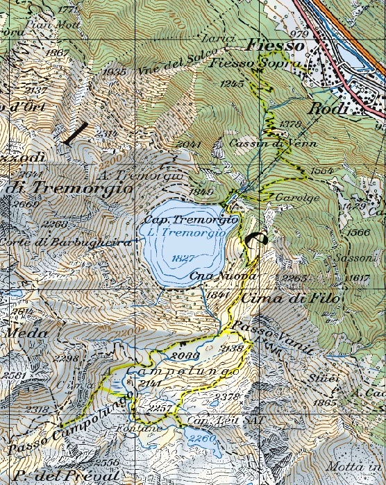
Lago Tremorgio e Passo Campolungo
Information
| Date: | 30 June 2006 |
| Maximum height: | 2318 m |
| Difference in height: | 1500 m |
| Length: | 15 km |
| Kilometers effort: | 35 kmef |
| Duration: | 8 hours |
| Huts reached: | Capanna Tremorgio |
| Capanna Leit |
| Lakes reached: | Lago Tremorgio |
| Lago Leit |
Difficulties

|
Lungo tutto il percorso fino a 500 metri dal Passo Campolungo. |

|
Gli ultimi 500 metri prima del Passo Campolungo. |
Comment (Automatic translation in english)
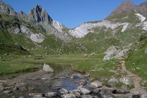
The path chosen by me starts from Fiesso, and is clean and quite signposted. After a long climb you get to the lake of Tremorgio, a basin famous for the hypothesis that it was created by the impact of a meteorite. On the shores of the lake we find the Tremorgio hut, reachable also through the cableway that connects the hut to Rhodes. Continuing to climb you get to Alpe Campolungo and then to the Leit hut and its lake. From here you can descend the slope and then go up towards the Passo Campolungo, which connects Valle Leventina with Val Lavizzara. During the climb to the pass you cross the splendid white rock that characterizes the whole area. This is the Dolomites Saccaroide Bianca. At the top of the pass you come across a shack, which was probably used to build the high voltage pylons that cross the pass. The way back is almost identical to that of going.
Map of the Path


Comments (0)