
Piz di Campedell
Information
| Date: | 29 August 2010 |
| Maximum height: | 2724.1 m |
| Difference in height: | 1550 m |
| Length: | 13 km |
| Kilometers effort: | 33.7 kmef |
| Duration: | 10 hours |
Difficulties

|
Da Landarenca fino a Piöv di Fuori, passando da Boliv oppure da Lego. |

|
Da Piöv di Fuori fino a quota 2090 metri nella Val del Galbines. |

|
Da quota 2090 metri fino alla Bocchetta di Pianca Geneura. |

|
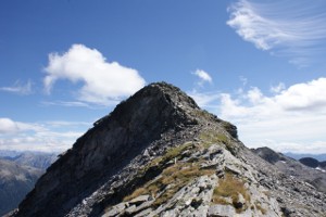
Da dove abbiamo lasciato il sentiero a quota 2260 metri fino in vetta e poi fino alla Bocchetta di Pianca Geneura. |
Comment (Automatic translation in english)
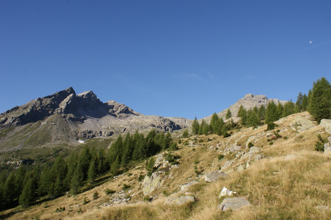
To get to the Piz di Campedell you can start from Selma, or take the cableway that starts from there and go up to Landarenca. The cable car is automatic (4 Fr round, 8 Fr round trip) and allows you to climb, at any time, up to the village above. From here it is possible to continue towards Boliv or Lego, and then continue in the woods of the Ross and Castaneda until you reach Alpe Piöv di Fuori. From the alp you start climbing towards the Val del Galbines, which crosses around 2090 meters. On the other side the path becomes a little more impervious but always well marked up to the Bocchetta di Pianca Geneura. But we left the path before and we went along the stone to reach, at an altitude of 2640 meters, north of the summit. Since the north side of Campedell's Piz has vertical rock walls, we decided to go around it to the east and thus reach the summit always on stony ground. For the return we went down from the west side, which at first sight seems steep, but then, looking better, it is passable. The steep section is only about ten meters long and there are at least 2 passages that allow you to cross it. We have come down near the north-west ridge, but we can also go further south. Then we continue along the stone that we have traveled in the morning up to 2400 meters, where we decide to reach the Bocchetta di Pianca Geneura bypassing the rocks from below. We then realized that there was a passage that crossed them and that emerged at an altitude of 2340 meters (visible on the map) but now we had taken another road. Actually there was also a track that seemed to cross these rocks at an altitude of 2400, but we preferred to take the safest route. From the nozzle you then descend along the trail to the Piöv di Fuori and from there again to Landarenca. As for water, there is a fountain in Landarenca, near the cable car stop, and then there are two rivers on the path to the Piöv Alp di Fuori. On the alp there is another fountain that is placed inside the enclosure of the animals. Then, in Val Galbines, you cross a river that represents the last source of water up to the summit.
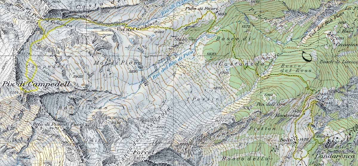
Map of the Path


Comments (0)