
Pizzo d'Era e Pizzo dei Torói
Information
| Date: | 31 July 2023 |
| Maximum height: | 2618 m |
| Difference in height: | 1090 m |
| Length: | 10.2 km |
| Kilometers effort: | 24.7 kmef |
| Duration: | 7 hours |
Difficulties (Automatic translation in english)

|
From Pian Segno to the fork at the altitude of 1753 metres, after Frodalera. |

|
From the altitude of 1753 metres to the altitude of 2300 metres (with some T3 passages). |

|
From the altitude of 2300 metres to the summit of Pizzo d'Era and then the descent to the altitude of 2580 metres. |

|
From the altitude of 2580 metres to the altitude of 2000 metres (with some T3+ passages). |

|
The ascent to Pizzo dei Torói (with several grade I climbing passages). |
|
|
From the altitude of 2000 metres to the return on the official trail at the altitude of 1762 metres (with some T3 passages). |
Comment (Automatic translation in english)
Today I decide to climb Pizzo d'Era, a mountain on the border between the Leventina Valley and the Blenio Valley. Since I am in the area, however, I will also try to climb Pizzo dei Torói.
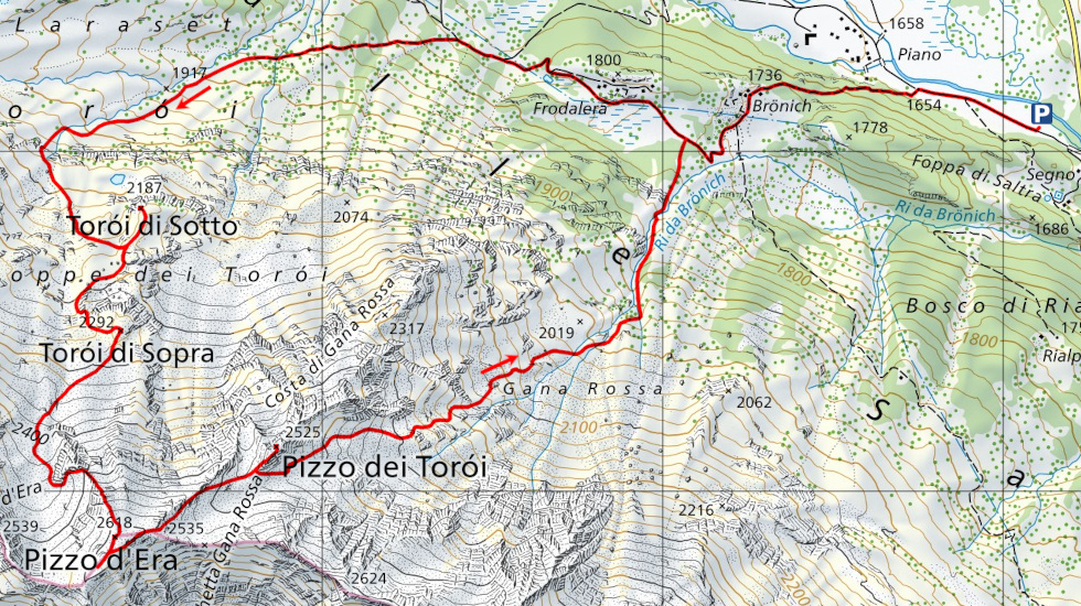
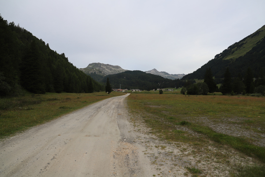
I leave my car in the car park at Pian Segno, along the road to the Passo del Lucomagno. The cost for the whole day is 5 francs. I then start walking along the dirt road that continues westwards for about 400 metres, after which I take the path up to Brönich. After passing Frodalera, I reach a fork, at an altitude of 1753 metres, from where a track starts that climbs towards the place called Torói. In the first section it can still be seen quite well, but then, at around altitude 1880 metres, it disappears. I then continue along the easy pastureland that climbs towards the Torói di Sotto, which I reach by circumventing the summit from the south. I then start climbing again and in a short time I also reach the second peak of the day, the Torói di Sopra. Now, however, the terrain begins to become more and more rocky. Towards an altitude of 2400 metres, I reach the north-north-west ridge of Pizzo d'Era, which I decide to cross on the right because the slope seems less steep on that side. I then climb up the small valley that climbs towards Bocchetta d'Era and then, at an altitude of 2500 metres, return to the ridge that I have just bypassed. Following the latter, I finally reach the summit.
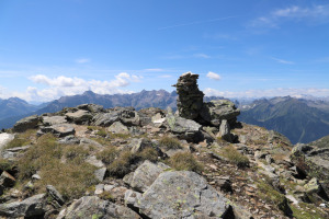
After my lunch break, I follow the south-west ridge of the summit for a short distance to better photograph the Lago di Carì. I then turn back and descend the mountain, following the north-east ridge in the direction of Pizzo dei Torói until I reach its slopes. From a distance its ascent looks difficult, but in reality there is a not too complicated route to the summit. First I start to climb following the south-west ridge until I reach a group of rocks. I then descend on the other side and continue on the east side of the mountain where there is a fairly wide strip of grass. I arrive in this way just below the summit, on the south side. Now one could climb a fairly steep grassy gully and reach the summit. However, I prefer to stay more to the left and climb up some rocks until I reach the ridge. Following it for about ten metres, I then reach the summit. The entire route, as mentioned, is not too difficult and the passages reach a maximum of grade I climbing. In some sections, however, it is a little exposed.
Having returned to the base of Pizzo dei Torói, I start to descend towards Brönich. The first section still presents some easy scree, which then, little by little, gives way to meadows. At an altitude of 2000 metres, a slight track appears, which descends to the right of the river but which disappears into the grass at certain points. At an altitude of 1820 metres I cross the Ri di Brönich to pass on the left bank and after 250 metres I arrive back on the official trail, which I follow until I return to the parking area at Pian Segno.
Water (Automatic translation in english)
There is a fountain in Brönich from which, however, little water flows and it is lukewarm. Just above it is the Ri da Brönich river into which, on the other hand, much fresh water flows. There are also a few streams on the way up to the Torói di Sotto.
Map of the Path


")


")

")


")


Comments (0)