
Sasso Gordona
Information
| Date: | 19 June 2008 |
| Maximum height: | 1410 m |
| Difference in height: | 850 m |
| Length: | 10 km |
| Kilometers effort: | 21.3 kmef |
| Duration: | 5 hours |
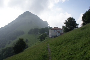
| Huts reached: | Rifugio Prabello (IT) |
Difficulties

|
Da Muggio fino al Rifugio Prabello. |

|
Dal Rifugio Prabello fino in cima e ritorno (alcuni passaggi esposti). |
|
|
Dal Rifugio Prabello a Cabbio. |
Comment (Automatic translation in english)
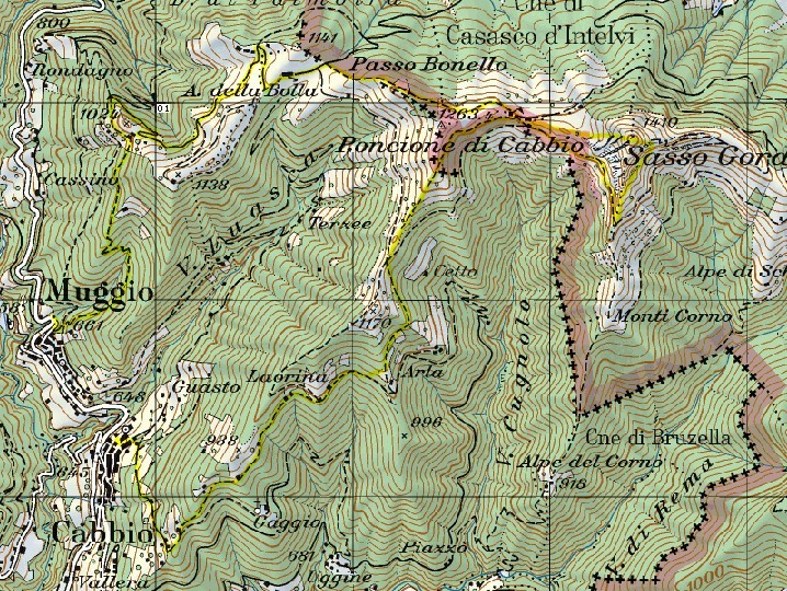
To go up to Sasso Gordona you can start from Muggio and follow the path that leads first to Alpe della Bolla and then to Passo Bonello. Once you reach the pass, continue on the path on the Italian side of the border until you reach the Prabello Refuge. From here you can reach the summit or from the west or from the east side, both with well visible paths and equipped with chains where you need it. On this top there are the remains of various forts of the famous Cadorna Line. This defensive line was built by the Italians along the border with Switzerland during the First World War, to defend against a possible Austro-German invasion. Back then to the Prabello Refuge you can go down another path and finally reach Cabbio.
Map of the Path


Comments (0)