
Pizzo Campo Tencia e Pizzo Tenca
Information
| Date: | 21 September 2010 |
| Maximum height: | 3071.7 m |
| Difference in height: | 1800 m |
| Length: | 17 km |
| Kilometers effort: | 41 kmef |
| Duration: | 10 hours and 30 minutes |
| Huts reached: | Capanna Campo Tencia |
Difficulties

|
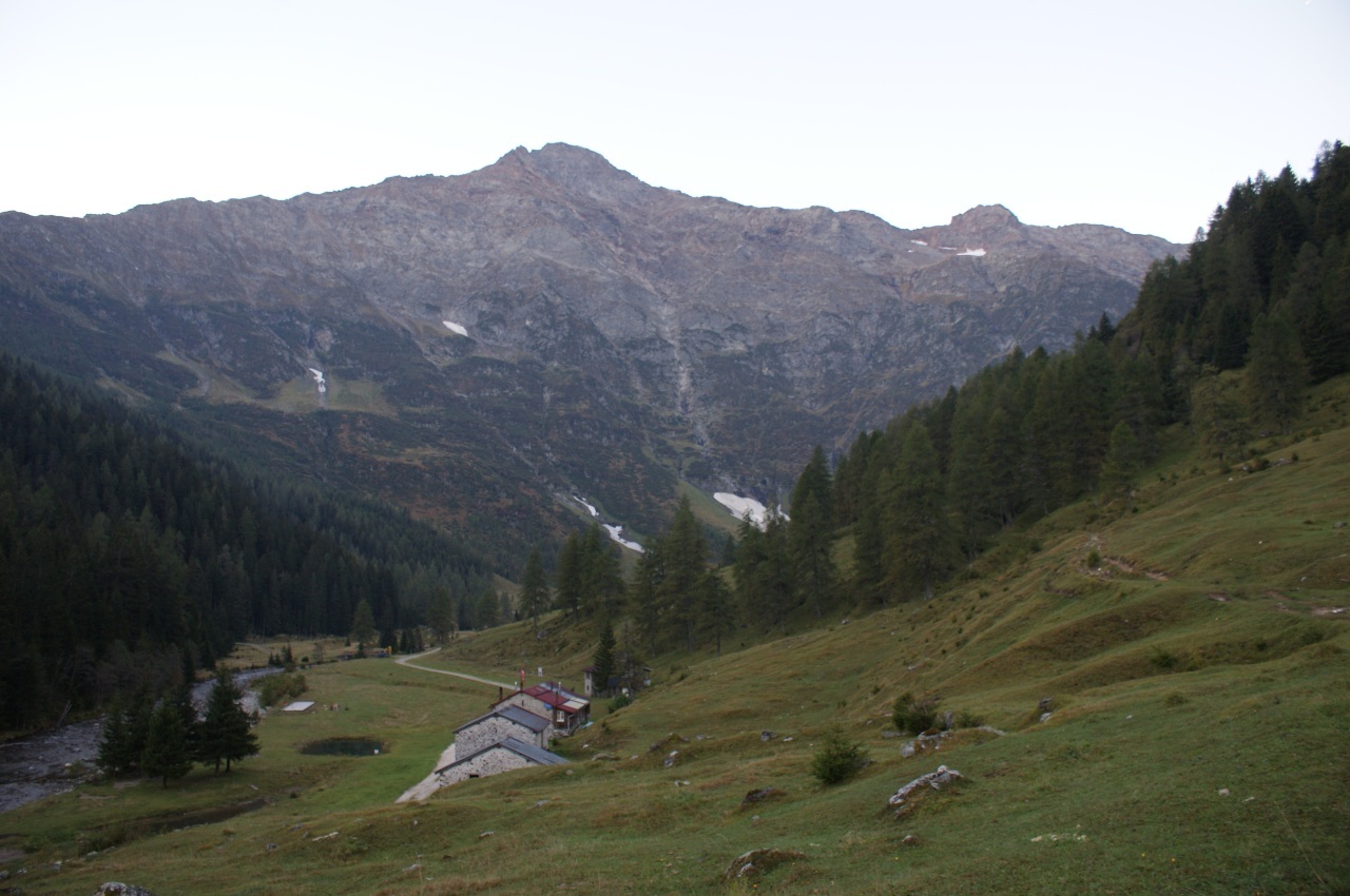
Dal posteggio di Piumogna fino alla Capanna Campo Tencia (T1 il primo pezzo su strada). |

|
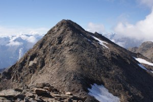
Dalla capanna fino al Pizzo Campo Tencia e poi fino al Pizzo Tenca (F il tratto sul ghiacciaio). |
Comment (Automatic translation in english)
For this excursion you can leave your car in the large parking area before the Piumogna bar, just after the bridge. Also on the road to the east of the river is a bar, immediately after the parking, which is not marked on the map. After leaving the car you can follow the road to Prati Géra and then go up, or take the path that starts from Piumogna. After the first section that climbs gently you reach Sgnòi, a wide plateau crossed by the river. From here the path becomes steeper despite the various zig-zags present. Once you have passed the steeper section you will come out on wide pastures and you will soon reach the Campo Tencia Hut. From the hut, overcoming scree slopes, you reach the wall placed in front of it. Looking from a distance it would seem impossible that there is a passage that crosses it. Instead, once under it, one understands that it was not as bad as it seemed at first. The path is however, at times, quite exposed and demanding, not suitable for those suffering from vertigo. When you reach the altitude of about 2430 meters, the road returns simpler and soon leads us to the lake at an altitude of about 2640 meters. Just above the pond you reach a saddle from which the Lake of Morghirolo is clearly visible. From here the trail becomes challenging again up to the altitude of about 2800 meters, after which you finally reach the Bocchetta di Croslina. From the pass you take the path that follows the ridge and leads to the summit. The descent on the other side is easier than the ascent (T3). From the nozzle at an altitude of 2974 meters you can then, if you wish, climb quickly even on Pizzo Tenca without particular difficulty. For the return you can then reach the bocchetta again and cross the remains of the glacier until you return to the path followed on the way. The glacier has a maximum slope of 30-35 ° and it was necessary to wear crampons. Maybe at other times of the year they are not necessary but it is always better to have them with you. Once you have passed the glacier, you return to the hut and from there to Piumogna. As for the water, there is a fountain near the bar of Piumogna and then another at the Capanna Campo Tencia. In addition to this there is the river in Sgnòi and Alpe di Croslina. Then there is the stream that flows from the pond about 2640 meters and then nothing more.
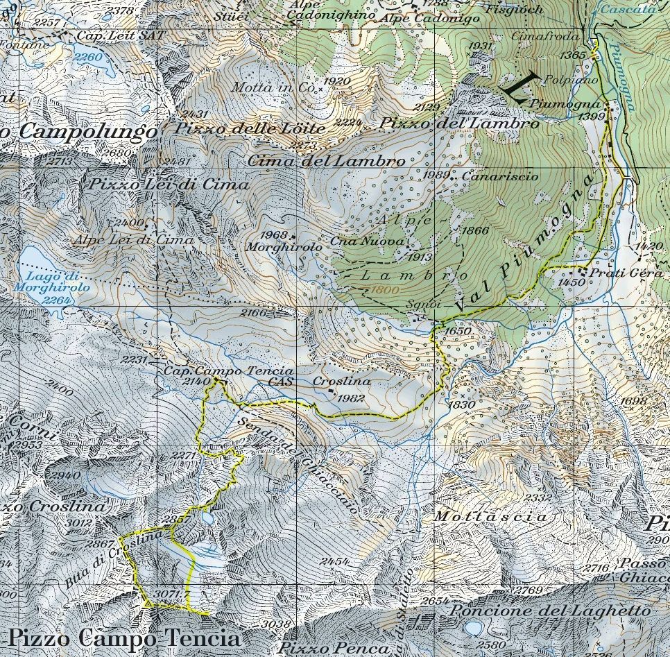
Map of the Path


Comments (0)