
Pizzo Nero e Chilchhorn
Information
| Date: | 16 July 2012 |
| Maximum height: | 2904 m |
| Difference in height: | 650 m |
| Length: | 7 km |
| Kilometers effort: | 15.7 kmef |
| Duration: | 6 hours |
Difficulties (Automatic translation in english)

|
From the car park to the lake below the Gonerlilücke. |

|
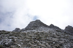
From the lake to the summit of Pizzo Nero (with a grade II climbing passage). |
|
|
From Pizzo Nero to the pass west of the 2743-metre altitude point. |

|
From the pass north of the Chilchhorn to the car park (T2 the path below the altitude of 2700 metres). |
Comment (Automatic translation in english)
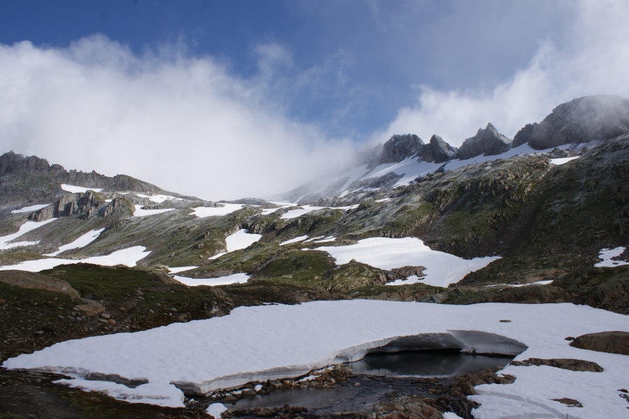
Just before the Nufenen Pass, just above the 2410 meter altitude, there is a car park where you can leave your car and then continue along the path towards the Gonerlilücke. When you reach the crest of Pizzo Nero, follow it up to the altitude of about 2840 meters, where a stretch of rock forces us to deviate to the south to get around it. You then climb along a crumbling rock channel, where it is better to stay on the left (West), which brings us back to the ridge. Just below the summit there is a passage of 2nd degree which, despite being only 2.5 meters long, can cause problems in crossing it since it is practically vertical and quite exposed. In a moment then you get to the summit where the space to turn around is not much but the view is wonderful. Descend from the summit, retrace the ridge to the Gonerlilücke where once was the highest hut in the Ticino that now unfortunately has fallen downstream with a nice piece of ridge. In his memory there remain only a bench and some boards saved from the precipice. Continue the journey westwards until you reach the path to the north of the Chilchhorn. Then follow it up to the North summit, the highest and easily accessible, and then continue to the South which instead has a steep and steep side. To go back down you continue to follow the path, which is not always easy to follow, up to the altitude of 2618 meters where you leave it to point directly to the parking lot that you can reach through the meadows and the stones.
Water (Automatic translation in english)
There are a few streams in the first section of the path, then there is the small lake below the Gonerlilücke and then nothing more, apart from snow, until the car park.
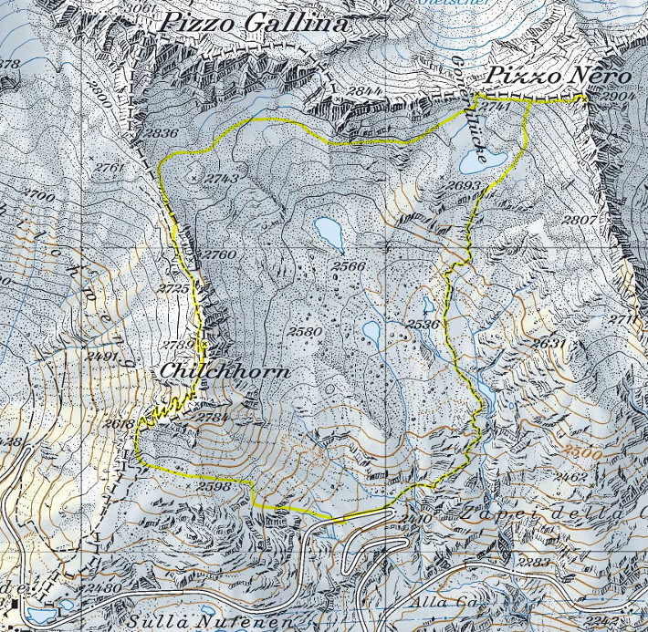
Map of the Path

Summits


Comments (0)