
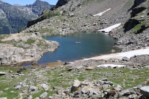
Lago di Porchiér
Information
| Date: | 10 July 2025 |
| Maximum height: | 2191 m |
| Difference in height: | 1200 m |
| Length: | 17 km |
| Kilometers effort: | 33 kmef |
| Duration: | 7 hours and 30 minutes |
| Lakes reached: | Lago di Porchiér |
Difficulties (Automatic translation in english)

|
From Cabiói to the fork at the altitude of 1,878 metres, where you leave the official trail. |

|
From the fork to Lake Porchiér (with some T3 passages). |
Comment (Automatic translation in english)
Today, 14 years after my last visit, I return to Val Vegornèss, but this time to climb up to Lake Porchiér.
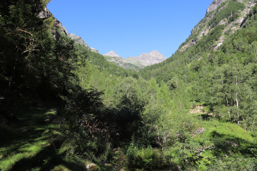
Once I reach Cabiói, I start walking along the path that climbs up to Corte di Fondo. I cross the river over a convenient bridge and continue on the other side of the valley. When I reach an altitude of 1,878 metres, I leave the path that climbs to Capanna Barone and follow a faint trail that starts on the left. The trail disappears from time to time, but this is not a problem because the terrain is not difficult to walk on.
I then head westwards on a slight descent until I cross the Verzasca river, which is still small and easy to cross here. On the other side, the trail disappears. I then turn south and begin to slowly climb the slope until I reach an altitude of 1920 metres, where I find the trail again. Now all I have to do is follow it, along a steeper path than the previous one, until I reach Alpe di Porchiér.
Once past the alp, I continue on a slight incline, still following a trail that leads to Lake Porchiér and which, after an altitude of 2110 metres, is only visible in places. There are also a few cairns to indicate the way. After an altitude of 2160 metres, the trail disappears completely, but the lake is now close and the route to follow is fairly logical. When I reach the hill at an altitude of 2225 metres, I finally see Lake Porchiér below me. I decide to go around it from the south to take several photos, after which I descend to its shores. The water is incredibly warm, even though there is still some snow at the edges.
After my lunch break, I climb back up the hill and descend again to Alpe di Porchiér. Following the same route as on the way up, I return to Cabiói, where this trip ends.
Water (Automatic translation in english)
There is a fountain in Cabiói and then some streams at an altitude of 1262 metres. There are more before Corte di Fondo, but there are cows in the area and the water may not be clean.
Higher up, I found a stream at an altitude of 1744 metres and finally a few more before reaching Alpe di Porchiér. After the mountain pasture, there are only a few small temporary springs.
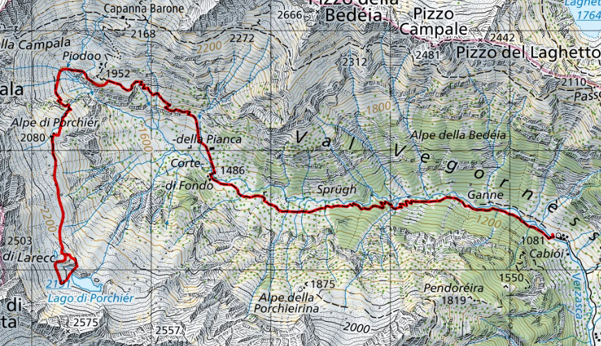
Map of the Path

Lakes
Other


Comments (0)