
Pizzo Marumo e Pizzo Corói
Information
| Date: | 19 September 2025 |
| Maximum height: | 2791 m |
| Difference in height: | 1070 m |
| Length: | 12 km |
| Kilometers effort: | 26.2 kmef |
| Duration: | 6 hours and 30 minutes |
| Huts reached: | Capanna Scaletta |
Difficulties (Automatic translation in english)

|
Along the entire route (with some T3 passages after leaving the trail at the altitude of 2376 metres). |
Comment (Automatic translation in english)
Pizzo Marumo and Pizzo Corói are two mountains located on the southern side of the Greina plateau. Their most distinctive feature is the anthracite grey rock they are made of, the same rock found in the Scopi and Passo di Gana Negra regions.
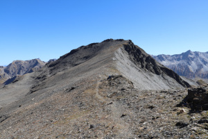
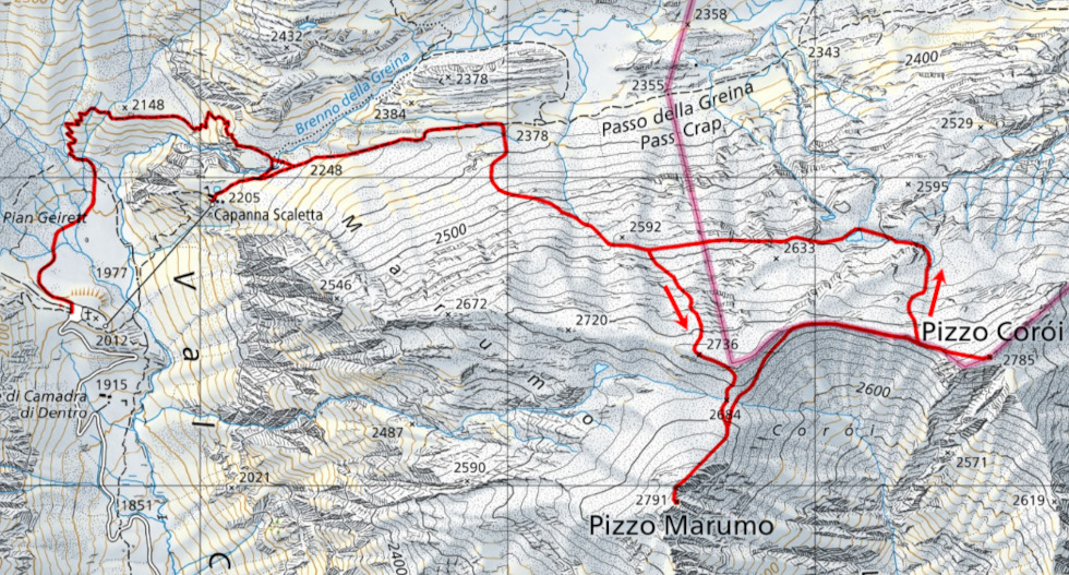
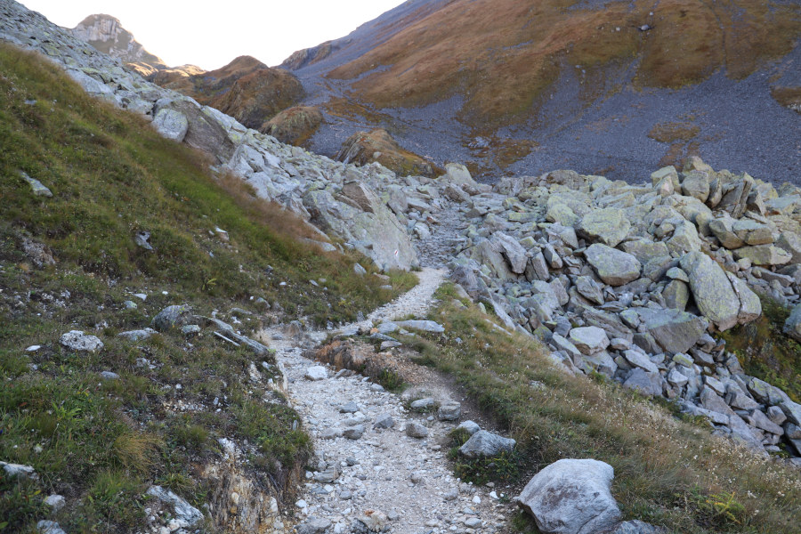
To reach these two peaks, I set off from Pian Geirett, at the top of Val Camadra, where I begin walking along the path that climbs towards Passo della Greina. Shortly before reaching an altitude of 2378 metres, I leave the path to climb to the right, along the southern side of the valley. On that side, there are some blue paint marks that climb up to Pizzo Corói and then descend to Capanna Motterascio. However, it is not always worth following them in the first section because they lead directly to the 2720-metre peak along a fairly steep path. I therefore prefer to leave them at an altitude of 2420 metres and continue south towards some cairns that I can see above me. Once I have passed them, I reach an easy track that heads east-southeast, which I had already seen on satellite images of the area. I follow it up to an altitude of 2530 metres, where it disappears. This is not a problem because the steepest section is now behind me. I continue in the same direction for about 300 metres, then turn south until I reach the summit at 2735 metres. At this point, Pizzo Marumo finally appears in front of me, with its gentle slopes and almost uniform grey colour. I then make a short descent of 50 metres to the Q2684 pass, before climbing up the other side and finally reaching the summit without any particular problems.
After eating something, I retrace my steps to the pass I reached earlier and then head towards the ridge that leads to Pizzo Corói. Once there, I find the blue markings I left earlier and also a trail heading east, which I follow until I reach the top. The view over the entire Greina plateau is truly beautiful, and now I can also see the side towards Capanna Motterascio.
For the return journey, I decide not to follow the same route as on the way up, but to try to descend towards the small lake at an altitude of 2592 metres. This alternative also has the advantage of taking me to an area where there is some water, which is useful as my reserves are beginning to run low. From above, I can see several streams that all converge in the lake. The descent on that side is not difficult and, after reaching that area, I continue westwards until I return to the route I followed in the morning. I then descend, following the same route, to the path at an altitude of 2376 metres, after which I follow it until I reach Capanna Scaletta. After a short break, I finally descend to Pian Geirett, where this trip ends.
Water (Automatic translation in english)
There are a few streams near Pian Geirett and then further north-west of Pizzo Corói. At Capanna Scaletta there is a fountain, but the water is not drinkable.
Map of the Path

Summits
Huts


Comments (0)