
Laghi Pero e Melo
Information
| Date: | 11 October 2021 |
| Maximum height: | 2436 m |
| Difference in height: | 1130 m |
| Length: | 13.5 km |
| Kilometers effort: | 28.5 kmef |
| Duration: | 6 hours and 30 minutes |
| Huts reached: | Capanna Grossalp |
| Lakes reached: | Lago Melo (Schwarzsee) |
| Lago Pero (Üssera See) | |
| Endersee |
Difficulties (Automatic translation in english)

|
From Bosco Gurin to the fork at Endra Staful. |

|
From Endra Staful to Lake Pero (with a few T3 passages). |

|
From Lake Pero to point 1 (see map). |
|
|
From point 1 to Bosco Gurin via Grossalp. |
Comment (Automatic translation in english)
Today's excursion aims to reach the Pero (Üssera See) and Melo (Schwarzsee) lakes above Bosco Gurin.
First of all I start to cross the village, following one of the numerous alleys until I come out in the meadows to the north-east. I then take the path that goes up to Endra Staful and, once there, continue on to Üssera Staful and finally arrive at Lago Pero. Needless to say, this lake takes its name from its shape, which resembles a pear. To photograph it better, however, you have to climb higher up, towards Bocchetta d'Orsalia.
After a short break, I started to descend towards Lago Melo, which is about 80 metres lower than the previous lake. The shape of this lake is circular and, with a bit of imagination, it may actually resemble an apple.
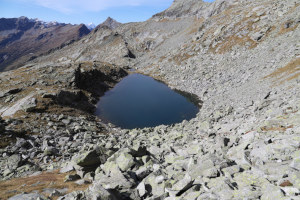
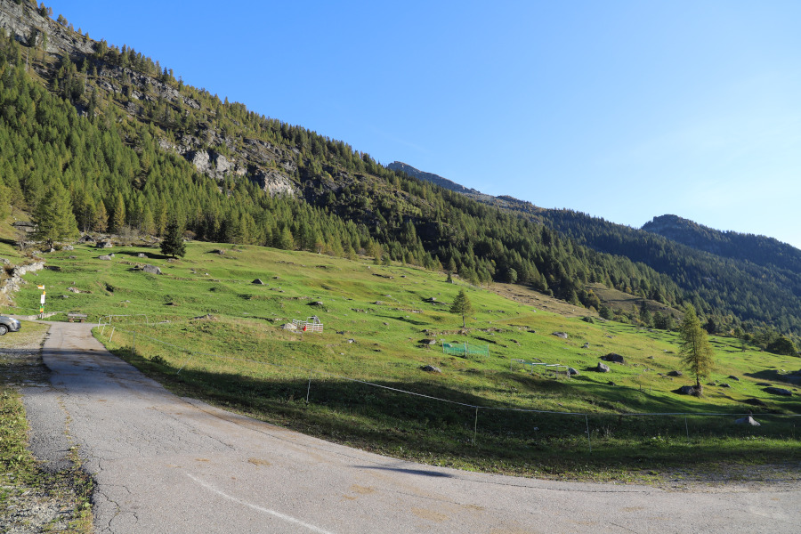
At this point, there is a path which I could have used to go straight back down to Bosco Gurin. However, I prefer to lengthen the trip a little and go up to see one last lake, smaller than the others, called Endersee (no name on the national map). After taking some photos, I continue for about 300 metres until I reach a small mouth at an altitude of about 2427 metres. On the other side, the path descends along a rocky gully, which is not particularly difficult. I then reach the Bann area where, immediately after the fork at 2181 metres, the path begins to descend towards Grossalp. At this point, be careful not to make a mistake, as I did, because there is another path, more visible than the official one, which continues on the flat. It is so clearly visible that you don't even think about checking the GPS to see if the route is correct. I later found out on the internet that other people had made the same mistake. It was no big deal, however, as the area is full of pastures and I only had to descend through the meadows until I found the right path again. Following the path, I finally arrived at Grossalp, first taking a look at the ski resort, which is closed at the moment. I then went back down to Bosco Gurin where, before ending the trip, I went to admire the village and the parish church.
As far as water is concerned, there are several fountains within the village of Bosco Gurin and then there is another one in the middle of the village of Grossalp. There are also several streams from Bann to Grossalp.
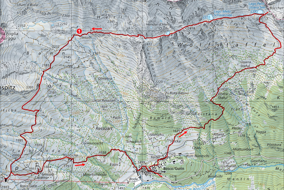
Map of the Path


_s.jpg "Torba (granaio)")


Comments (0)