
Poncione di Nara e Pizzo di Nara
Information
| Date: | 19 July 2021 |
| Maximum height: | 2432 m |
| Difference in height: | 900 m |
| Length: | 8.5 km |
| Kilometers effort: | 20.5 kmef |
| Duration: | 6 hours |
| Huts reached: | Capanna Piandios |
Difficulties (Automatic translation in english)

|
From Gariva to the fork at the altitude of 1919 metres. |

|
From the fork at the altitude of 1919 metres to the Bocchetta di Sasso Bianco. |

|
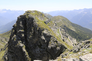
From Bocchetta di Sasso Bianco to Poncione di Nara (with a T4 passage near Sasso Bianco). |

|
From Bocchetta di Sasso Bianco to the S-S-W ridge of Pizzo di Nara (with T4 passages). |
|
|
From the S-S-W ridge of Pizzo di Nara to the summit of the peak and descent to Croce del Mottarone |

|
From Croce del Mottarone to the fork at the altitude of 1919 metres. |
Comment (Automatic translation in english)
Today's destination is the Poncione di Nara, the younger brother of Pizzo Molare which I reached last year.
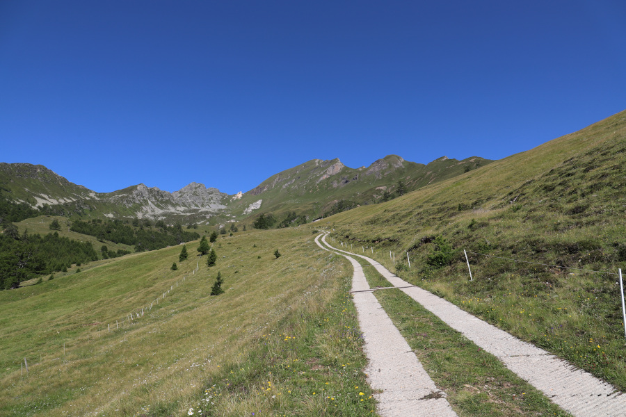
First we reach the village of Gariva (on the map Ghiariva) in the Blenio valley. We start walking along the small road, closed to traffic, which leads to the Piandios Hut. From the hut we continue, still following the road, in the direction of Pian Laghetto. At the fork in the road at an altitude of 1919 metres, turn right and start climbing up the easy grassy slopes until you reach the path at an altitude of 2340 metres and, after a short while, the Bocchetta di Sasso Bianco. From the pass, descend for about fifteen metres on the Leventina side until you reach a small gully that you climb up to return to the crest. Continue southwards until you reach the north summit of the Poncione di Nara. At this point, we descend the opposite side of the peak, which is a little more demanding than the previous one and where we need to pay a little more attention. Once we reach the small mouth below, we finally climb up to the south summit of Poncione di Nara, which is also the higher of the two, without too many problems.
After lunch, we return to the Bocchetta di Sasso Bianco and start to descend again from the path we took on the way up. After a few hundred metres, we leave the path and head towards the Bocchetta (2247 m), which we reach after crossing a short scree slope about 70 metres long. From the pass we continue to follow the track that goes straight towards Pizzo di Nara, going round the summit from the west side, until we reach the crest that rises from Bassa di Nara. Climbing up the ridge, we soon reach the top of the peak.
For the return trip, we descended along the meadows in the direction of Croce di Mottarone where we reached the path coming from Bassa di Nara which led us back to Capanna Piandios and finally back to Gariva.
As for water, there is a fountain at Capanna Piandios and then a few streams that cross the road.
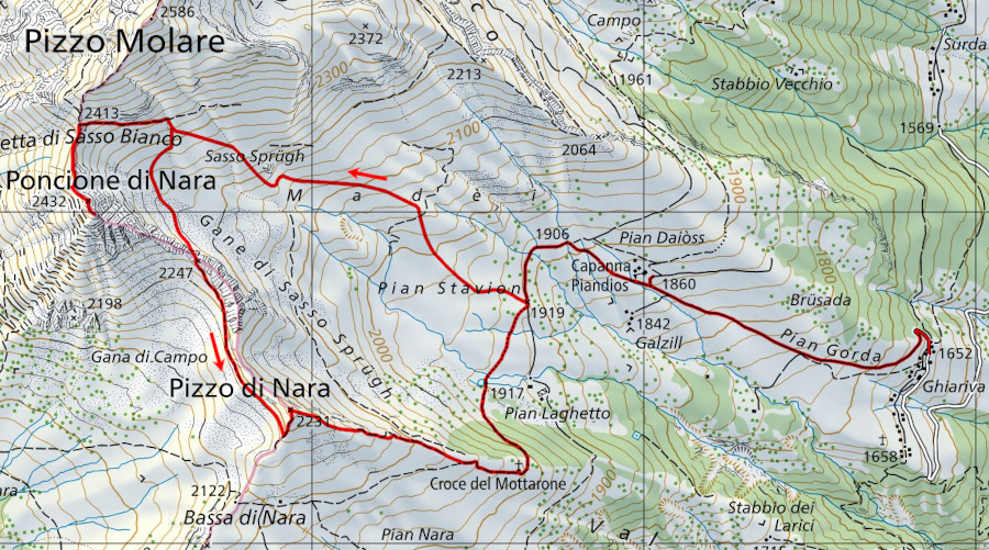
Map of the Path


")


Comments (0)