
Capanna Garzonera e Lago di Prato
Information
| Date: | 18 August 2012 |
| Maximum height: | 2085 m |
| Difference in height: | 760 m |
| Length: | 11.6 km |
| Kilometers effort: | 21.7 kmef |
| Duration: | 5 hours |
| Huts reached: | Capanna Garzonera |
| Lakes reached: | Lago della Valletta (Sopra Garzonera) |
| Lago di Prato |
Difficulties (Automatic translation in english)

|
From Giof to Pian Taiöi. |

|
From Pian Taiöi to the altitude of 1883 metres. |
|
|
From the altitude of 1883 metres to the Garzonera Hut and from there to Cascina di Lago (some T3 passages before Lago di Prato). |
|
|
From Cascina di Lago to Pian Taiöi. |
|
|
From Pian Taiöi to Giof (T1 the variant on the road via Camperitt). |
Comment (Automatic translation in english)
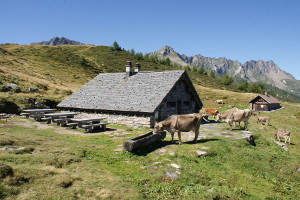
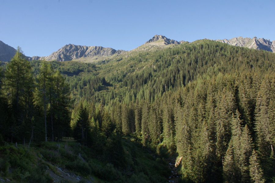
Today's tour starts from Giof, where there are about fifteen parking spaces. Eventually it is also possible to start from Segna, just above Nante. From Giof follow the road that climbs towards Cassin for about 100 meters, then take the path that climbs into the woods to the right. The trail, which is very beautiful and has a good slope, leads us in a short time to Pian Taiöi where it joins the dirt road coming from Giof. We follow it up to the altitude of 1883 meters where, with a last stretch of trail, we reach the Garzonera hut. The hut is very beautiful and in alpine style and is located on a plateau offering an exceptional view of the Alps to the north, from the Gotthard to Lake Ritom and beyond. Definitely a refuge to visit, even more than once. We continue the journey towards the South and in a short time we reach the Valletta Lake where there is a stone dam that was probably used to provide water to the mountain pastures below. Continue west along a path that has some T3 steps to N-W del Motto del Toro, but that itself is not very difficult. So we finally reach the Lake of Prato, very beautiful and green. For the return you can get off at Cascina di Lago and from there, along the road, reach Zemblasca and then Pian Taiöi. Here we resume the path that descends to Giof but with possibly a variant that provides the transition from Camperitt.
Water (Automatic translation in english)
There is a fountain at Giof, one at the Capanna Garzonera, one at Alpe Garzonera and one more at Camperitt, near the bridge. In addition, there is the river at Zemblasca, there are a few streams along the route and there are two small lakes.
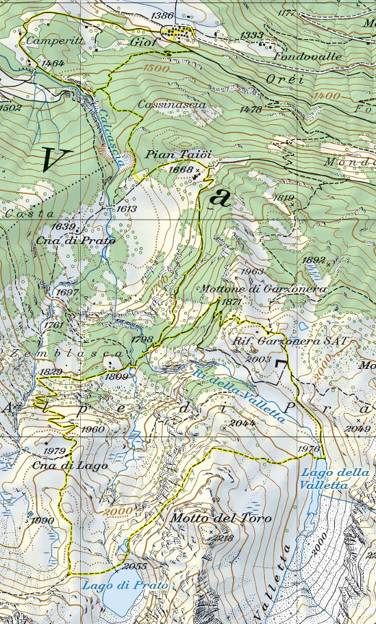
Map of the Path

Huts
Lakes
Other


Comments (0)