
Corno di Gesero e Cima delle Cicogne
Information
| Date: | 22 November 2020 |
| Maximum height: | 2227 m |
| Difference in height: | 680 m |
| Length: | 8 km |
| Kilometers effort: | 17.1 kmef |
| Duration: | 4 hours and 30 minutes |
| Huts reached: | Vecchia Capanna Gesero |
| Capanna Gesero |
Difficulties (Automatic translation in english)

|
From Alpe di Cadinello to Corno di Gesero (with T3+ passages from 2000 to 2080 metres altitude). |

|
From the Corno di Gesero to the fork below the Cima delle Cicogne (with T4 passages from 2110 to 2080 metres altitude). |

|
From the crossroads to the Cima delle Cicogne and back to the new Capanna Gesero in the Biscia area. |

|
From the new Gesero Hut to the old one and from there to Alpe di Cadinello. |
Comment (Automatic translation in english)
Today we climbed the Corno di Gesero and the Cima delle Cicogne, two mountains located between Ticino and Grigioni.
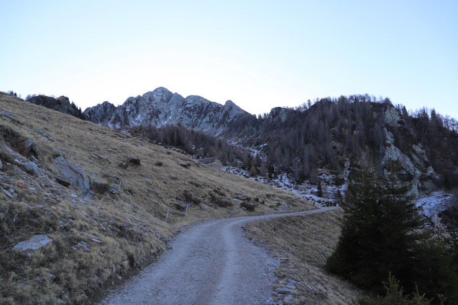
First of all, we reach the village of Cadolcia along an interminable road, narrow in places and with very steep sides.
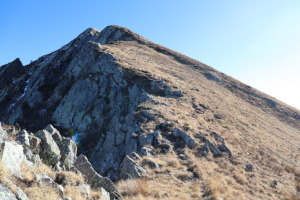
We then start to climb along the path that starts from the Alpe di Cadinello, where we are lucky enough to see two chamois escaping into the meadows. When we reach 2000 metres, we encounter a rocky ridge which we cross without too many problems thanks to a grassy slope. At the top of the slope, there is a short rocky passage where you need to use your hands to hold on.
At this point we are on the opposite side of the ridge and we finally meet the sun, which is very low in this almost winter month. We continue to climb southwards, occasionally encountering a few small rocky passages up to an altitude of around 2080m, where the path becomes fairly easy again.
We thus reach the summit of Corno di Gesero where, in addition to a small wooden cross, there is also a military installation with large satellite dishes.
After a break at the summit, we start walking again, this time towards the Cima delle Cicogne. This part of the path is less beautiful than the previous one and very often the track disappears and good orientation skills are needed to continue (GPS is very useful). The most challenging section is the one that goes from 2110 to 2080 metres where there are a few exposed sections where it is important to choose the right path.
Once you have overcome the difficult part, continue along a grassy stretch until you reach the junction with the path that comes from Biscia. Now the path is much easier and in a short time we reach the point at 2191 metres where we meet another military structure, much larger than the previous one and difficult to get around outside the fence. In order to reach the top, there is no other way but to enter the enclosure of the structure, go around the building on the left thanks to some stairs and exit at the back.
After a hundred or so metres, we finally reach the Cima delle Cicogne itself, marked by a small stone cairn. About sixty metres after the summit, we discover the presence of an ancient military fort, which testifies to the fact that the entire region around the San Jorio Pass was of strategic importance in view of a possible invasion from the south during the First World War.
We continue our walk and descend in the direction of Biscia, where we find the new Capanna Gesero, almost completed. The refuge has been converted from an old military barracks and will be inaugurated in 2021. Continuing to descend, 240 metres further down, we reach the current Capanna Gesero, also built from an old military building and which unfortunately will be demolished in the future.
From the hut, we return to Alpe di Cadinello, along a slightly uphill road, when it is already getting dark. However, this circumstance allows us to admire a splendid sunset.
Water (Automatic translation in english)
We found an open tap at the new Gesero hut and a closed fountain for the winter at the old hut. Just north of the latter there is also a river.
Map of the Path
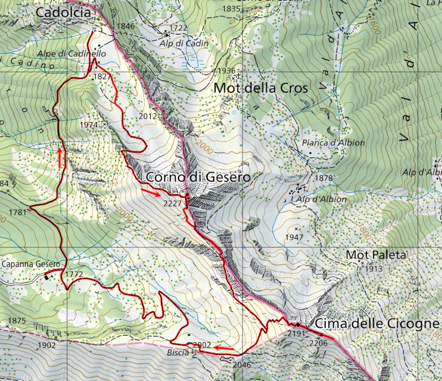

Summits
Huts


")

")


Comments (2)