
Giro del Pizzo Colombe
Information
| Date: | 20 July 2020 |
| Maximum height: | 2381 m |
| Difference in height: | 750 m |
| Length: | 14 km |
| Kilometers effort: | 24 kmef |
| Duration: | 5 hours |
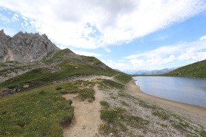
| Lakes reached: | Lago Pécian |
| Lago dei Campanitt |
Difficulties (Automatic translation in english)

|
From the car park to the Passo del Sole. |

|
From the Passo del Sole to Lago Pécian and back (if you avoid stones, otherwise T3). |
|
|
The ascent to Passo delle Colombe and the descent to the parking area (T2+ the section between the pass and Piano dei Canali). |
Comment (Automatic translation in english)
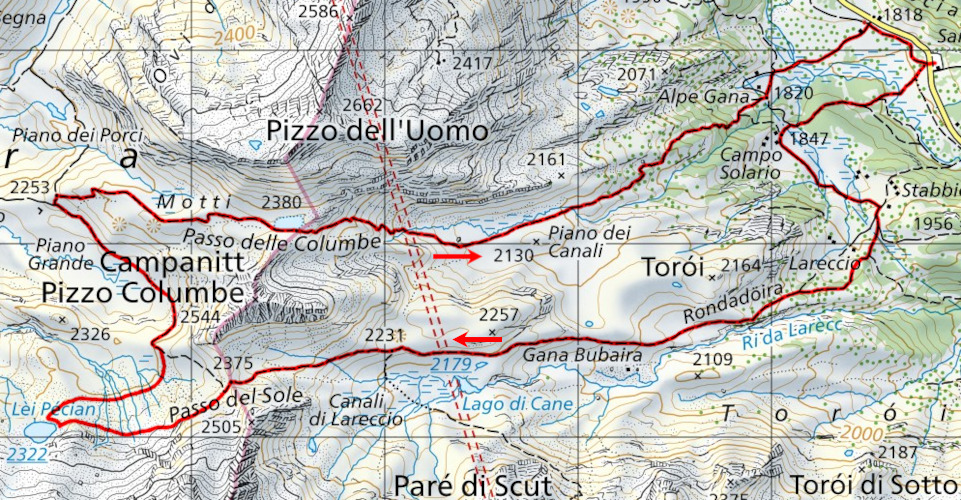
My trip today begins at the Lukmanier Pass, or more precisely a few kilometres earlier.
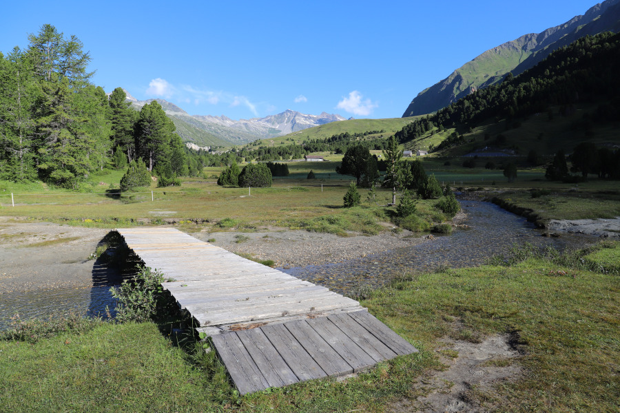
Along the main road, just before arriving at Alpe Casaccia, there is a large pay car park (5.- fr. for the whole day) which can also be reached by public transport.
You then start walking westwards in the direction of Campo Solario and Stabbio Nuovo, after which you continue until you reach Passo del Sole. From the pass, if you wish, you can take a trip to Lake Pécian, only 1 km away. To reach it I left the official path already near the pass and I remained quite high while I was heading to the lake. Maybe it was not the best choice because I found many stones along the way. I suggest to cross the plateau lower down, as I did on the way back, where there is much more grass.
Once back on the main path continue north-west until the fork at 2253 meters above sea level, then turn right and climb the easy grassy slopes up to Passo delle Colombe (which who knows why it is now called Columbe on the new maps, but on the signs in the area is still marked as Colombe). Once you reach the pass you go back down to the Piano dei Canali along a path rather devastated and ruined by water. When you finally reach the plateau, you return, passing by Alpe Gana, to the starting point.
This tour is of course also possible in the opposite direction, but if you don't like slopes that are too steep, I suggest you first climb up to Passo del Sole, which is less steep, and then descend from Passo delle Colombe.
Water (Automatic translation in english)
There is a fountain at Stabbio Nuovo and one at Alpe Gana. Then there are many streams between the Passo del Sole and Lago Pécian.
Map of the Path

Lakes
Other


Comments (0)