
Giübin e Pizzo Prevat
Information
| Date: | 5 August 2025 |
| Maximum height: | 2876 m |
| Difference in height: | 940 m |
| Length: | 15.5 km |
| Kilometers effort: | 28 kmef |
| Duration: | 7 hours |
| Lakes reached: | Laghetto degli Ovi Settentrionale |
| Laghetto degli Ovi Meridionale | |
| Lago del Pizzo Prevat |
| For the following peak, there are other variants of the ascent: | Giübin |
Difficulties (Automatic translation in english)

|
From the San Gottardo Pass to the Posmeda Pass (T1 the first section on the road). |
|
|
From the pass to the summit of Giübin and then on to the Sella Pass (with some T2+ sections). |

|
From the pass up to the altitude of 2760 metres. |

|
From the altitude of 2760 metres to the summit of Pizzo Prevat and then the descent to Rotstocklücke (with some T4 passages). |

|
The descent to the south of Lake Pizzo Prevat (mainly due to the fairly steep slope and the risk of slipping). |
|
|
From the lake to Cascina di Val Torta (T1 the section of road to the San Gottardo Pass). |
Comment (Automatic translation in english)
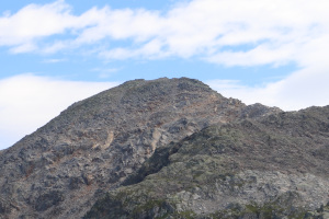
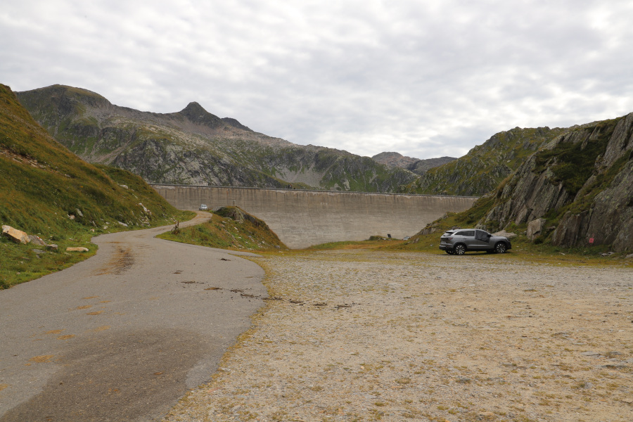
Pizzo Prevat (not to be confused with Pizzo del Prévat in the Campolungo region) is a mountain located in the San Gottardo massif, not far from Pizzo Centrale. To reach it, I start walking along the road, closed to traffic, which starts from the San Gottardo Pass and leads to the Lago della Sella dam. I then take the path that climbs to the Posmeda Pass and continue until I reach the summit of Giübin, following the same route I took in 2022 (more photos here). After a short break at the summit, I set off again, descending to the Sella Pass, where I leave the path and continue along the ridge that climbs northwards. Up to an altitude of 2760 metres, the terrain is fairly easy to follow because it consists of small rocks. Then you encounter larger stones and the difficulty increases a little, without however becoming too great. I finally reach the summit, where I find a cairn with a plaque dedicated to the Ticino Federal Councillor Giuseppe Motta. For the return journey, I decide to take an alternative route and go and see Lake Pizzo Prevat (unofficial name) up close. First, I reach the Rotstocklücke pass by following the western ridge of the mountain, where there are still some rocky sections to cross. I then turn left and begin to descend along the gully that leads to the lake, which has a fairly steep slope. For this reason, this section is the most challenging of the entire trip and you need to be careful on the descent because some of the rocks are unstable and there is a risk of falling. When I finally reach the lake, I go around it on the left side and then begin to descend along Val Prevat. Grass begins to reappear on the ground, although there are still some small rocky areas. At an altitude of 2450 metres, the valley narrows and its sides become steeper. However, I manage to find a passage between the rocks without too much difficulty to continue and pass the narrowest part. At this point, the valley floor widens and, after a final descent along a slightly steep meadow, I reach Cascina di Val Torta. Following the dirt road that runs alongside Lago della Sella, I return to the dam and finally to the San Gottardo Pass.
Water (Automatic translation in english)
There are a few streams north of Lake Pizzo Prevat and then the river that flows out of it, which can be reached as far as Cascina di Val Torta. There are also a few more streams north of Lake Sella.
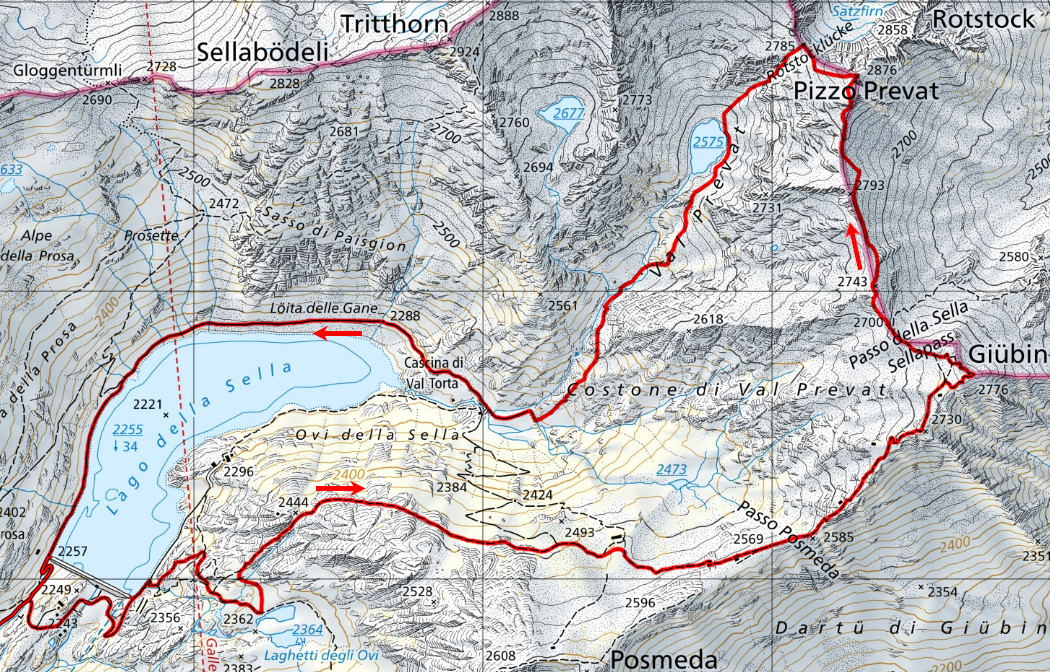
Map of the Path

Summits
Lakes


Comments (0)