
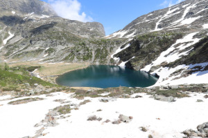
Lagh de Trescolmen
Information
| Date: | 15 June 2021 |
| Maximum height: | 2025 m |
| Difference in height: | 800 m |
| Length: | 10 km |
| Kilometers effort: | 20.6 kmef |
| Duration: | 5 hours |
| Lakes reached: | Lagh de Trescolmen |
Difficulties (Automatic translation in english)

|
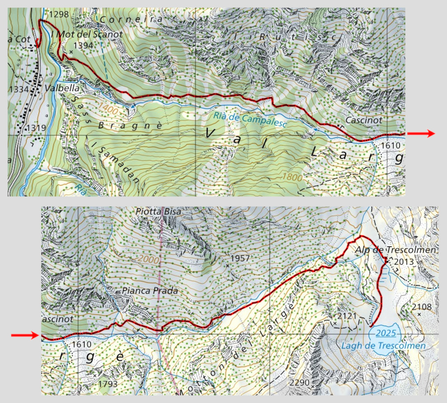
From Valbella to the crossroads at the altitude of 1610 metres. |

|
From the crossroads at the altitude of 1610 metres to the altitude of 1620 metres (approx. 70 metres in length). |
|
|
From the altitude of 1620 metres to the Lagh de Trescolmen (with some T3 passages). |
Comment (Automatic translation in english)
Today's hike takes place at the top of the Val Calanca and is aimed at the Lagh de Trescolmen.
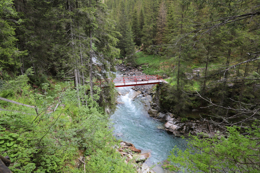
First of all I reach the large car park situated immediately after the village of Valbella. The first part of the path is downhill and leads to the Calancasca river, which is easily crossed thanks to a comfortable bridge. On the other side of the river, start climbing towards Cascinot through the Val Largé. At the crossroads at an altitude of 1,610 metres, there is a scree slope about seventy metres long that makes the path quite challenging. After this section, continue without too many problems until the ford at an altitude of 1803 metres. In fact, if the river is in flood, it is very difficult to cross it because of the current. It is therefore inadvisable to do this trip in spring when there is a lot of water due to the melting snow. Unfortunately, I didn't know this, but fortunately, a hundred or so metres upstream, I found a large mound of snow that crossed the river and allowed me to pass. Back on the path I continued to climb without problems until the ford at an altitude of 1928 meters where, again because of the river current, I still encountered some problems to cross. After a last uphill stretch I finally reached the Alp de Trescolmen and after about 300 meters, the lake.
After taking the usual photos, I descended again by the same route as before.
Water (Automatic translation in english)
There are a few fountains in Valbella and then the river in several places from altitude 1600 metres upwards.
Map of the Path

Lakes
Other


")


")


Comments (0)