
Monte Lema
Information
| Date: | 14 April 2007 |
| Maximum height: | 1620.6 m |
| Difference in height: | 880 m |
| Length: | 9.5 km |
| Kilometers effort: | 21.2 kmef |
| Duration: | 5 hours |
| For the following peak, there are other variants of the ascent: | Monte Lema |
Difficulties (Automatic translation in english)

|
From Breno to the altitude of 821 metres. |

|
From the altitude of 821 metres to the summit. |
Comment (Automatic translation in english)
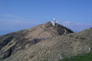
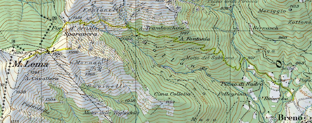
For this trip I left from Breno, but you can also climb from Miglieglia. From Breno you can follow a road blocked by a bar that leads you into a valley. From here you take a path that leads first to the Alpe Fontanía and then to the Alpe Tramboschino. From here you reach the Forcola d'Arasio and finally the summit. This variant, compared to the second, has the advantage of not following the cableway of Lema all the time and is therefore quieter.
Water (Automatic translation in english)
There is a fountain near the bridge at altitude 821 metres and another at Forcola d'Arasio.
Map of the Path

Summits


Comments (0)