
Pécian e Pécianett
Information
| Date: | 18 August 2021 |
| Maximum height: | 2764 m |
| Difference in height: | 980 m |
| Length: | 10.5 km |
| Kilometers effort: | 23.5 kmef |
| Duration: | 6 hours and 30 minutes |
| Lakes reached: | Lago Grande di Chièra |
| Lago Piccolo di Chièra |
Difficulties (Automatic translation in english)

|
From Somprei to the top of the Pécian. |

|
From the Pécian to the pass between the Pécian and the Pécianett (climbing grade II). |
|
|
From the pass to the top of the Pécianett (presence of somewhat exposed passages). |

|
From the pass to the Chièra Lakes (T3+ the first 100 metres of the descent). |
|
|
From the Chièra Lakes to Somprei. |
Comment (Automatic translation in english)
Today I am taking you to the Pécian and the Pécianett, two mountains located in the Leventina Valley whose name, in the local dialect, means comb and little comb. The Pécianett, however, in spite of its name, is the highest peak of the two.
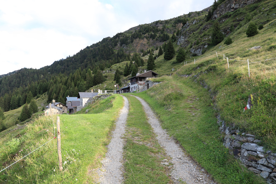
The excursion starts from Somprei, a village above Faido that can be reached via a narrow road that climbs up from Predèlp, near Carì. At the top there is a free car park with a voluntary offer.
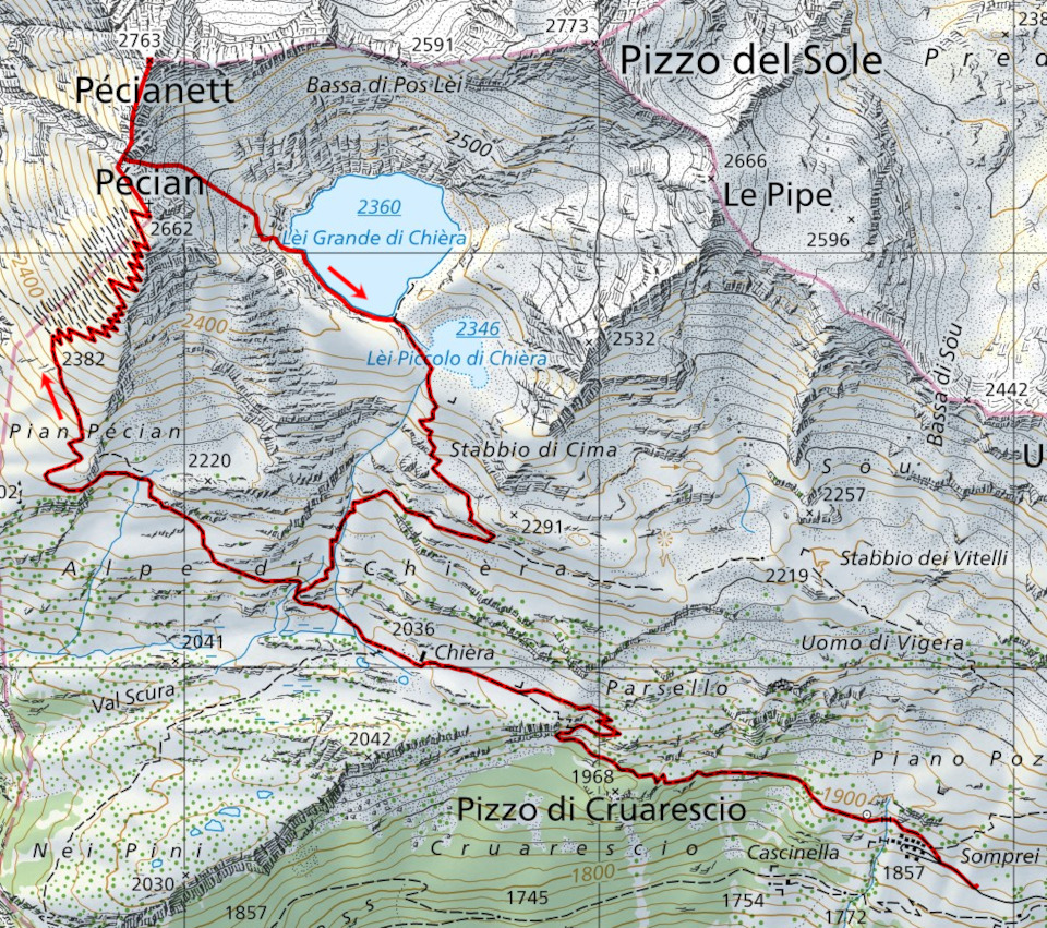
I start walking along the easy path that goes up to Alpe di Chièra, after which I continue to climb up to the fork at 2090 metres. At this point, I must be careful not to follow the path on the right, which leads to the Chièra lakes, but take the one on the left, which is a little less marked than the other. I then continue towards Pian Pécian along a path that in the first stretch occasionally disappears.
However, as I climb, the situation improves somewhat and the track becomes clearly visible again. At the crossroads at an altitude of 2,382 m, you will come across an infinite number of avalanche shelters, all built in stone at the end of the 1800s to protect the villages below. The path climbs between them at a constant gradient until it reaches the summit.
On the summit of Pécian there is a large cross, more than 13 metres high and built in 1901. The panorama is stupendous and sweeps over the entire Leventina Valley and the small lakes below.
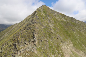
Now begins the most difficult part of the excursion. After a moment's rest I set off again, following the Pécian ridge northwards. I descend to an altitude of 2649 metres, where there is a grade II passage that leads to the pass between the Pécian and the Pécianett. The descent along this stretch, which has a difference in height of about ten metres, is made easier by the presence of a metal cable to which one must hold on. After a few last rocks, I finally reach the nozzle and start climbing on the other side. Almost the entire ascent takes place on the south ridge of the Pécianett, or a few metres to the right of it. Only at the beginning is there a small group of rocks that I preferred to pass on the left. The ascent of the peak itself is not too difficult, but in many places it remains quite exposed and is not recommended for those who suffer, even slightly, from vertigo.
There is a small stone cairn on the summit and the view is truly remarkable, especially over the nearby Val Piora.
After the lunch break, I descend to the pass by the same route I took on the way up, and then continue along the gully that leads to Lago Grande di Chièra. This section does not present any great difficulty; one must only pay attention to the stones, which occasionally move, and to the gravel on which one risks slipping. Towards an altitude of 2480 metres, the scree ends and the meadows begin. Fifty metres further down, you need to start moving to the right to avoid ending up on the rocks above the lake. On its shores, there is a small track that allows me to go around the lake towards the south, until I return to the official path near Lago Piccolo di Chièra. At that point, I easily descend to the Alpe di Chièra and finally return to Somprei.
Water (Automatic translation in english)
There is a fountain at Somprei and then two more at Alpe di Chièra.
Map of the Path

Summits
Lakes


")

")


")


")

")

")


Comments (0)