
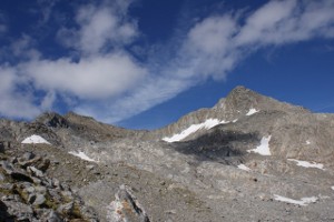
Piz Valdraus e Piz Gaglianera
Information
| Date: | 12 September 2010 |
| Maximum height: | 3121 m |
| Difference in height: | 1750 m |
| Length: | 18 km |
| Kilometers effort: | 41.3 kmef |
| Duration: | 10 hours |
| Huts reached: | Capanna Scaletta |
Difficulties (Automatic translation in english)

|
From the Alpe di Fontana San Martino to Pian Geirètt (T1 if following the road). |
|
|
From Pian Geirètt to the Capanna Scaletta (T4 if following the direct route). |

|
From the Capanna Scaletta to the Piano della Greina and from there to the summit of Piz Valdraus and almost to Piz Gaglianera. |

|
The last 20 metres of ascent to Piz Gaglianera (with some grade II climbing passages). |
Comment (Automatic translation in english)
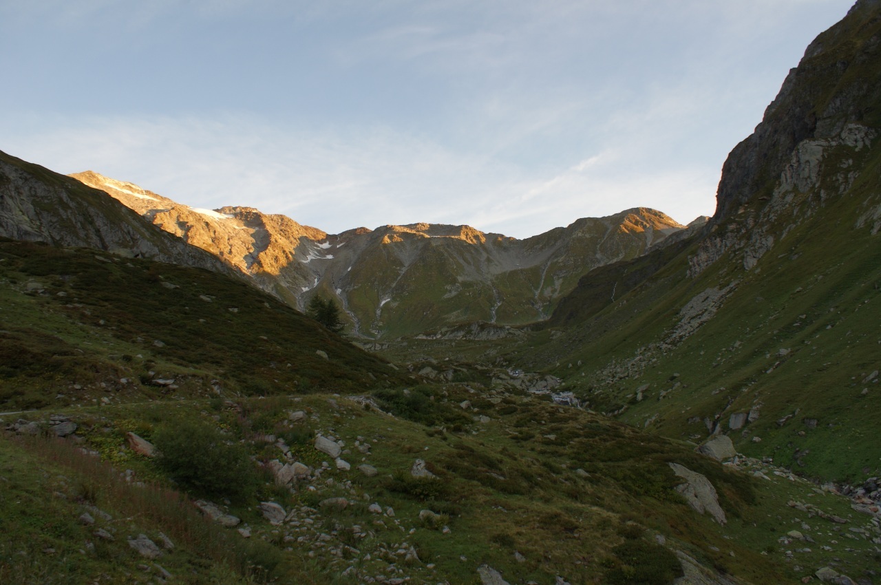
When you reach Val Camadra, you can leave your car in the car park before the barrier at Alpe di Fontana San Martino. From here you can ascend either by following the path or more gently by following the road. When you reach Pian Geirètt, continue along the official path that leads to Capanna Scaletta or, alternatively, by the direct route that climbs steeply below the hut. This path is clearly visible and does not present any particular difficulties. Nevertheless, it is to be considered a dangerous path, especially if taken downhill or when the ground is wet, due to the fact that it is very exposed, particularly in the upper half. Two signs, one at the beginning and one at the end, advise against passing through those who are not experts. Reached the Brenno della Greina, climbing up from the normal path, you can see on the left of the blue and white signs detach from the path and enter the rocky area north of the river. This path then enters a very beautiful gorge, which presents rocks of many colors alternating with more grassy stretches. However, there are points where the track becomes very narrow (10 cm) and you have to walk carefully. Those who do not feel like it can always get around the gorge by following the path that leads to Passo della Greina and leaving it, shortly after the 2378 meters altitude, to head north. In both cases we reach the Piano della Greina, where you can see the poles that mark the beginning of the path leading to Fuorcla Sura da Lavaz, north of the river. We follow this track to the north and climb up to just below the nozzle. Here you leave the path and continue along the rocks towards the north-east. You wander over the ledge at an altitude of 2853 meters and then head north until you reach the Piz Valdraus. The last section goes up to N-N-O. At this point the idea was to get on the Piz Gaglianera following the north-west ridge, but since the north side was still covered with snow, I preferred to circumvent the lace and go up from the south. This itinerary does not present particular difficulties apart from the last 20 meters where the slope becomes steeper (T4 +). If you stay on the S-S-E ridge, there are stable but large rocks that require short climbing passages (2nd grade). On the other hand, if you go further towards the west, the rocks decrease but there remains a rather friable detritic slope. On this side there is even, sometimes, a trace that rises.
Water (Automatic translation in english)
There are several streams up to the hut, where there is a fountain. Then there is the Brenno della Greina and further up there is the stream that connects the second pond with the first. Then there are a few more streams in the basin south of Piz Valdraus, at an altitude of around 2900 metres. From there upwards there is nothing more.
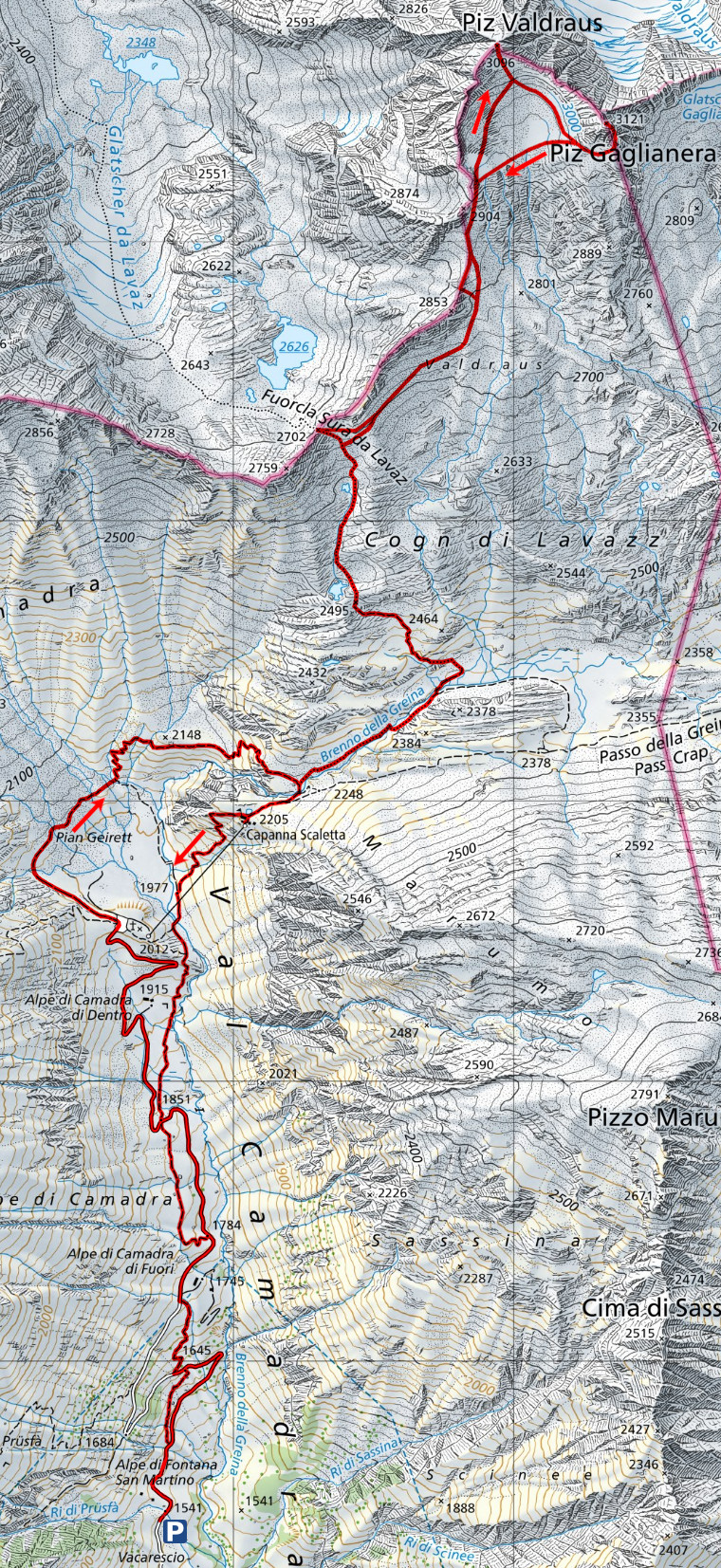
Map of the Path

Summits
Huts


Comments (0)