
Piz Medel e Cima di Camadra
Information
| Date: | 1 September 2021 |
| Maximum height: | 3210 m |
| Difference in height: | 1400 m |
| Length: | 10 km |
| Kilometers effort: | 28.6 kmef |
| Duration: | 10 hours |
| For the following peak, there are other variants of the ascent: | Cima di Camadra |
Difficulties (Automatic translation in english)

|
From Pian Geirett to the altitude of approx. 2610 metres (with some T4 passages). |

|
From the altitude of 2610 metres to the south ridge of Piz Medel (altitude 3165 m) (F the glacier passages). |

|
The last 250 metres of the ridge to Piz Medel. |
|
|
From the south ridge of Piz Medel to the Cima di Camadra (F the glacier passages). |
|
|
From Cima di Camadra to Pian Geirett via Cento Valli (T3 the last 300 metres of the descent). |
Comment (Automatic translation in english)
Piz Medel is a mountain located on the border between Canton Ticino and Canton Graubünden, not far from the Greina plateau. Its height of 3210 metres makes it one of the highest peaks in the area.
Departure is from Pian Geirett, at the top of Val Camadra, which can be reached on foot or by the Greina bus. You then start walking along the path, marked in white and blue, that climbs to the Pass d'Uffiern. To shorten the route a little, it is best to leave the path before reaching the pass. Many people leave the path at 2330 metres, but I preferred to follow it a little further up to 2610 metres. This part of the path has been moved a few years ago and on the national map 1:25'000 the change is not yet visible (on the 1:10'000 it is).
After leaving the official path, I start to climb along the scree slope that climbs towards the summit at 2772 meters, which I bypass to the right. Once I reach the ridge, I follow it northwards until I reach the Cima di Camadra. This section is full of small valleys where you have to move left and right to find the best route. Having arrived at an altitude of 3020 metres, in order to avoid an unnecessary up and down climb, I wanted to try to go round the Cima di Camadra passing by the eastern side. The first stretch on scree is not particularly difficult. Once you have crossed the east ridge, however, you come to a small glacier which, in the absence of snow cover, requires the use of crampons. Continuing northwards, I reach the main glacier, called Vadrecc di Camadra, which I climb up, staying close to the edges. Once I reach the rocks again, I climb up to the south ridge of Piz Medel following a slight track that rises slightly to the right of the direct route. I then turn north, initially following the edge of the ridge and then moving to the right when the more difficult rocks begin.
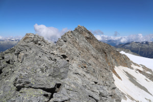
I finally reach the summit of Piz Medel, where there is very little room to move. On the other hand, the view of the Medel glacier on one side and Val Camadra on the other is fantastic. On the summit there is also a beautiful cross and a summit book.
After the lunch break, I descended again by the same route to the Vadrecc di Camadra. Since I now intend to climb the Cima di Camadra as well, I cross the glacier trying to stay as high as possible so as not to lose altitude unnecessarily. Also in this section, when there is no snow, the use of crampons is recommended. Once past the glacier, all that remains is an easy scree slope to reach the summit. On the summit, this time, I only find a large stone cairn.
I then descend on the other side, staying fairly close to the south ridge, until I reach an altitude of 3100 m where I turn south-east. In this way, I reach the scree slope that I had already crossed in the morning and the ridge that leads to the summit at 2772 metres. This time, however, I decide to descend towards Pian Geirett, further north than the previous day, and to cross the Cento Valli. I then follow an endless gully, full of stones and with some rocky drops, which brings me back to the point at 2315 metres. At that point, following the path, I quickly descend to Pian Geirett.
Water (Automatic translation in english)
There is little water along the route. I only found a small stream going down the gully that crosses the Cento Valli, towards an altitude of 2460 metres.
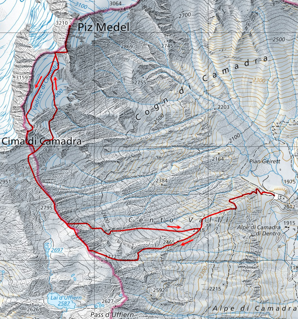
Map of the Path

Summits


")


")

")

")
")

")

")


Comments (0)