
Piz Rondadura
Information
| Date: | 28 August 2011 |
| Maximum height: | 3016 m |
| Difference in height: | 1160 m |
| Length: | 11.5 km |
| Kilometers effort: | 26.9 kmef |
| Duration: | 7 hours |
Difficulties (Automatic translation in english)

|
From the Lukmanier Pass to the altitude of 1924 metres. |

|
From the altitude of 1924 metres to the altitude of 2092 metres (with T3+ passages due to poor trail maintenance). |

|
From the altitude of 2092 metres to the summit. |
Comment (Automatic translation in english)
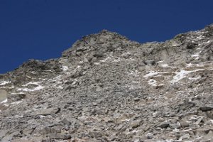
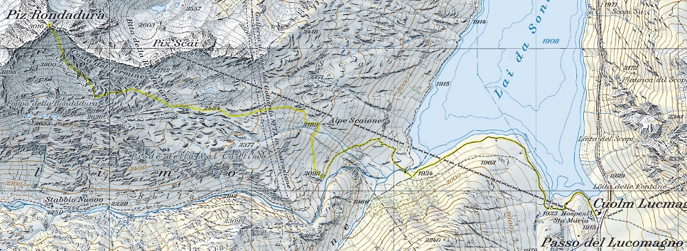
Leave the car at the Passo del Lucomagno and continue along the dirt road up to the altitude of 1924 meters. Here a sign indicates the beginning of the path that leads to Val Cadlimo. We begin to follow it up to the altitude of 2092 meters. Here we abandon it to continue among the rhododendrons towards the Alpe Scaione and then we go up the slopes, a little grassy and a bit 'stony, heading towards the Bocchetta della Rondadura. We pass it to the south and we go up the last slope towards the summit keeping us roughly on the S-S-E side. The last 30 meters are characterized by large enough stable blocks.
Water (Automatic translation in english)
Besides the fountain on the Lukmanier Pass, there are several streams up to an altitude of around 2600-2700 metres.
Map of the Path

Summits


Comments (0)