
Pizzo Caslett, Pizzo Alto e Pizzo Erra
Information
| Date: | 25 June 2022 |
| Maximum height: | 2416 m |
| Difference in height: | 780 m |
| Length: | 10 km |
| Kilometers effort: | 20.4 kmef |
| Duration: | 4 hours and 30 minutes |
| For the following peak, there are other variants of the ascent: | Pizzo Erra |
Difficulties (Automatic translation in english)

|
From Grasso Vecchio to the Crastumo Pass (T1 the road sections). |

|
From Passo Crastumo up to Pizzo Caslett (with some T3 passages just before the summit). |

|
From Pizzo Caslett to Pizzo Alto. |

|
From Pizzo Alto up to Pizzo Erra and then back down to the altitude of 2330 metres. |
|
|
From the altitude of 2330 metres to the road at 2203 metres (then T1 to Grasso Vecchio). |
Comment (Automatic translation in english)
The main focus of today's excursion was Pizzo Caslett and Pizzo Alto, two mountains on the border between the Leventina Valley and the Blenio Valley. While I was at it, however, I also took the opportunity to return to Pizzo Erra, a little further south.
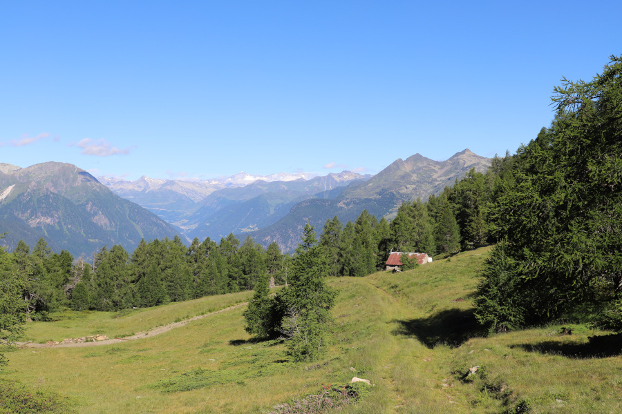
We first reach Anzonico and then continue on to Monte Angone. We then continue to climb along the road until we almost reach an altitude of 1900 metres where we leave the car in a small clearing.
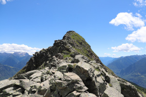
We then start walking along the road that leads to Cascina di Laghetto and continue along the path that leads to Passo Crastumo. Without much difficulty we follow the ridge up to Pizzo Caslett, where we only encounter some rocks in the last few metres.
After a short break, we set off again in the direction of the nearby Pizzo Alto where we encounter the most difficult section of the entire trip (T4). There are in fact some rocky passages, but they are never too complicated or exposed. On reaching the summit we find several metal circles that are supposed to turn when the wind blows. In reality only one was spinning while the others were too encrusted to move.
On the other side of the mountain, the descent is a little easier and allows us to reach the vent at an altitude of 2307 metres. At that point, in order not to lose altitude, we decide to cut across the avalanche shelters and walk directly towards Pizzo Erra. After a few metres we find a track, marked with pink spray, that leads in that direction and we follow it. It was probably made in order to reach the shelters and check or repair them. Every now and then the track splits, but always following the highest one we manage to reach the path coming from an altitude of 2198 metres. Following the latter, we soon reach the summit of Pizzo Erra, the highest peak of the day. Before starting to descend, we also make a detour to the north summit, at 2413 metres, to take a few photos.
For the return journey, we follow the fairly easy path down to an altitude of 2198 metres, where we reach the road that takes us back to our starting point.
Water (Automatic translation in english)
We could not find any anywhere.
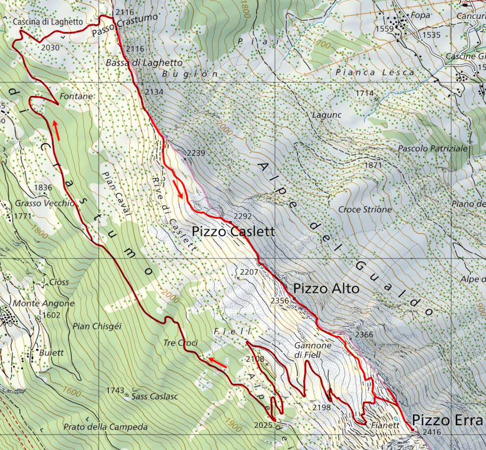
Map of the Path

Summits


Comments (0)