
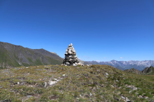
Pizzo di Cadrèigh
Information
| Date: | 8 August 2020 |
| Maximum height: | 2516 m |
| Difference in height: | 1050 m |
| Length: | 15.5 km |
| Kilometers effort: | 29.5 kmef |
| Duration: | 7 hours |
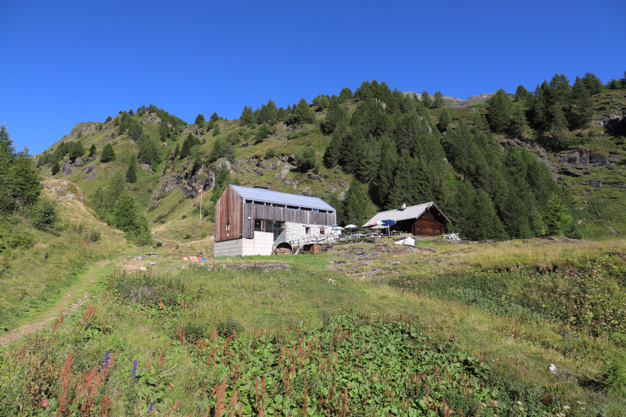
| Huts reached: | Capanna Bovarina |
Difficulties (Automatic translation in english)

|
From Predasca to the west summit of Pizzo di Cadrèigh. |

|
From the west summit of Pizzo di Cadrèigh to the east summit. |

|
From the east summit of Pizzo di Cadrèigh to Cantonill (some sections are T3). |

|
From Cantonill to Predasca. |
Comment (Automatic translation in english)
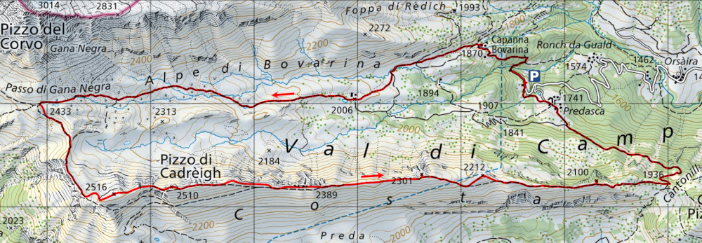
When I reach the area north-west of Predasca, where there is a large car park, I start climbing towards the Bovarina Hut. I then climb up the whole Val di Campo, passing through the Alpe di Bovarina, until I reach the Passo di Gana Negra. The last two kilometres of this stretch are characterised by the presence of numerous black rocks, precipitated by Pizzo del Corvo, which have created a suggestive environment.
When I reach the pass I turn south and climb the gentle and easy slopes that lead to the western peak of Pizzo di Cadrèigh. Between the two existing peaks this is the highest, but for some obscure reason on the map the name of the lace has been put next to the other.
At this point I start to walk along the coast in an easterly direction and after a slight descent I reach the most technical part of the whole trip. There are in fact some rocks to go around and then a grassy gully to go up again. This part of the route has been marked with green paint and is never really exposed. However, it is not suitable for those who suffer from vertigo.
Once you have passed the technical section you can reach the eastern peak of Pizzo di Cadrèigh in a short time. It is also possible to get around the part you have just walked along a path further south, but you will lose a lot of time unless you decide to leave out the eastern peak.
At this point I continue to follow the coast in an easterly direction, climbing up all the summits. It is not obligatory to do so, however, because in many places the path goes around them further down. On this part of the route the path is not always well visible but the grassy ridge is still quite easy to walk along.
Once you have reached the village of Cantonill, turn north-west and continue along a nice path to Alpe Predasca and the starting point.
Water (Automatic translation in english)
There is the river through the Alpe di Bovarina and then there is the river northwest of Predasca.
Map of the Path

Summits
Huts


Comments (0)