
Pizzo Molare
Information
| Date: | 4 September 2020 |
| Maximum height: | 2586 m |
| Difference in height: | 950 m |
| Length: | 8 km |
| Kilometers effort: | 20.6 kmef |
| Duration: | 5 hours |
| Huts reached: | Capanna Piandios |
Difficulties (Automatic translation in english)

|
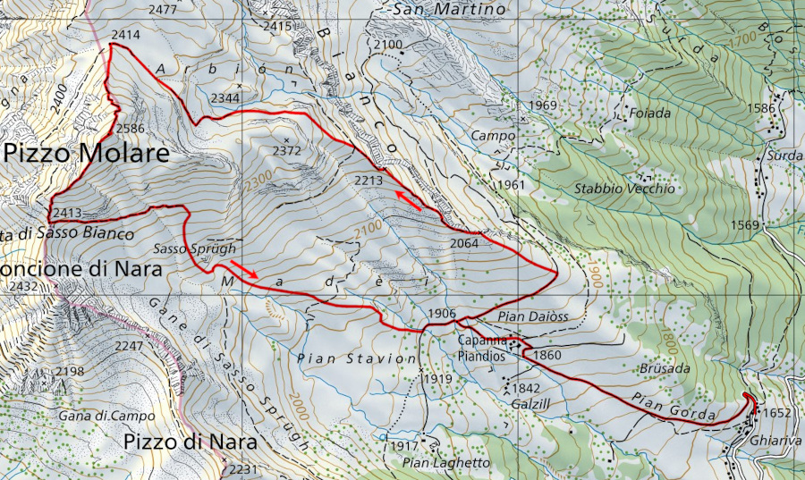
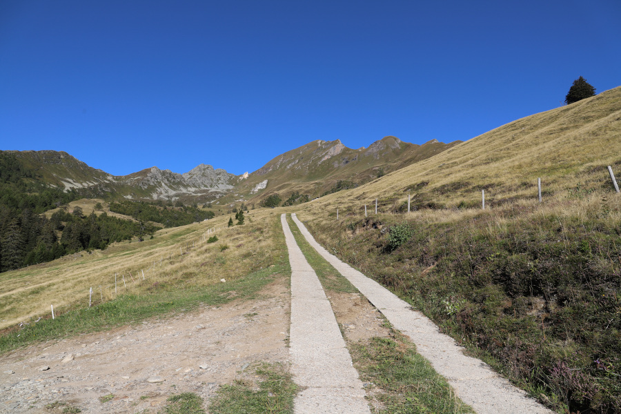
From Ghiariva to the Piandios Hut. |

|
From the Piandios Hut to the north of Pizzo Molare at the altitude of 2414 metres. |

|
From the altitude of 2414 metres to the summit from the north. |
|
|
From the summit to the Capanna Piandios via the Bocchetta di Sasso Bianco. |
|
|
From the Piandios Hut to Ghiariva. |
Comment (Automatic translation in english)
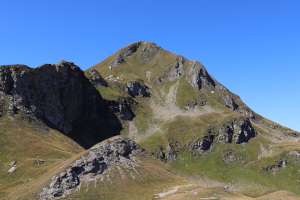
Today's destination is Pizzo Molare, a beautiful mountain between Val di Blenio and Valle Leventina.
Once you reach the village of Ghiariva, start climbing on foot along the little road up to the Piandios Hut. After passing the hut by about 200 metres, turn right and continue until you reach an altitude of about 1950 metres. At this point, leave the little road and begin to climb along the ridge between meadows and traces of a path. At about 2240 metres, there is a path that goes towards Arbión, but it is steep and at risk of landslides. I therefore preferred to climb higher up, where there is still a track that quickly takes us to the northern slopes of Pizzo Molare. From here, there is nothing left to do but to head south and overcome the final stretch, following the traces of the path and some signs of green paint.
To return, you can descend from the more direct route in a south-westerly direction, along a slightly easier path than the previous one, to the Bocchetta di Sasso Bianco. From here, the path continues towards Capanna Piandios, but at around 2300 metres it almost disappears. However, this is not a big problem because the meadows are not so steep and you can descend wherever you like. Once you get to the hut, you will soon be back in Ghiariva.
Water (Automatic translation in english)
There is a fountain at the Piandios Hut and a stream in the Arbión area, which can be dry in dry periods.
Map of the Path

Summits
Huts


Comments (0)