
Pizzo Sascòla
Information
| Date: | 15 June 2023 |
| Maximum height: | 2057 m |
| Difference in height: | 1540 m |
| Length: | 16 km |
| Kilometers effort: | 36.5 kmef |
| Duration: | 10 hours |
| Lakes reached: | Lago di Sascòla |
Difficulties (Automatic translation in english)

|
From Linescio to Corte Grande. |

|
From Corte Grande to the altitude of 2050 metres, just north of Pizzo Sascòla (T2+/T3 to 1900 metres). |

|
The last few metres to the summit and then the ridge southwards for about 200 metres (with 2 short II+ grade climbing passages). |
|
|
The descent to Lago di Sascòla (with some T4 rocks to cross). |
|
|
From Lago di Sascòla to Linescio along the low path. |
Comment (Automatic translation in english)
Today's excursion has Lake Sascòla as its objective, but since I am in the area I decide to also climb the nearby Pizzo Sascòla.
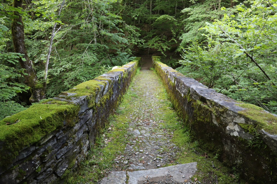
Having reached the village of Linescio, I start walking along the path that descends towards the Rovana river, which I cross on a beautiful stone bridge. On the other side of the valley, I begin to climb in the middle of the forest along the direct route that leads to Rotonda. When I reach Rotonda, I take the path that climbs towards Lago di Sascòla to the fork at an altitude of 1700 metres. At that point I turn right and after 300 metres reach Corte Grande.
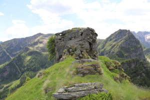
I then continue along the easy meadows behind the alp until I approach the east ridge of Pizzo Sascòla. I then head left, in the direction of the summit, along terrain that gradually becomes more and more full of rhododendrons, blueberries and junipers. I try to avoid them as far as possible but around 1940 metres I reach an area where I am forced to cross them. The most difficult part I found around 1980 metres where I had to climb up a slope, with a fairly marked gradient, full of bushes. Once past that section, the terrain improves a little and some grass reappears. I thus reach the north ridge of the summit, at an altitude of around 2050 metres. A few metres to the south is the summit of Pizzo Sascòla, but to reach it you first have to climb a short section (II+ grade). It is possible to circumvent the summit from the west side (a little exposed) and then reach it by climbing up the ridge from the south side (I+ grade climbing). On the summit I find only a small stone cairn.
After a break I set off again following the ridge southwards. After about 60 metres I reach a large boulder which I decide to go round to the right, passing between the rock face and a larch tree. I then continue for another 70 metres until I reach another rocky section that this time I am obliged to climb (II+ grade). Having passed this passage, the most difficult section is now behind me. I descend southwards along the ridge, which gradually becomes wider and wider.
Having reached the pass at an altitude of 1958 metres, one could start to descend directly towards the lake and this would certainly be the less tiring choice. However, I want to go around it from the south in order to take some photos, as it is more photogenic from that side. So I head in that direction staying high to avoid having to cross the rhododendrons that also cover this side of the mountain. After 250 metres, however, I have to start lowering myself where the ground begins to fill with bushes. Some small scree slopes to cross also appear. The section south-west of the lake is also a bit steep, making me struggle quite a bit. Finally, however, I manage to get to an area from where I can see my photographic subject well and where I can take several photos. Once I have finished, I start to descend towards the lake. I then go around it from the east side, following a slight track, until I reach the official path, which I follow as far as Corte del Lago.
At this point, to avoid following the same route taken in the morning again, I decide to take the path that descends immediately towards the valley floor. I thus reach Morella di Dentro and then Morella di Sotto. At that point I turn left and after a further descent I again reach the bridge over the Rovana river. I cross it and after a final climb I am back in Linescio, where this tour ends.
Water (Automatic translation in english)
There is a fountain in Linescio, one in Rotonda and one in Morella di Sotto. I found one more in Corte Grande and one in Corte del Lago, but both were closed and without water. Apart from that there are a few streams along the low path down to Morella di Dentro.
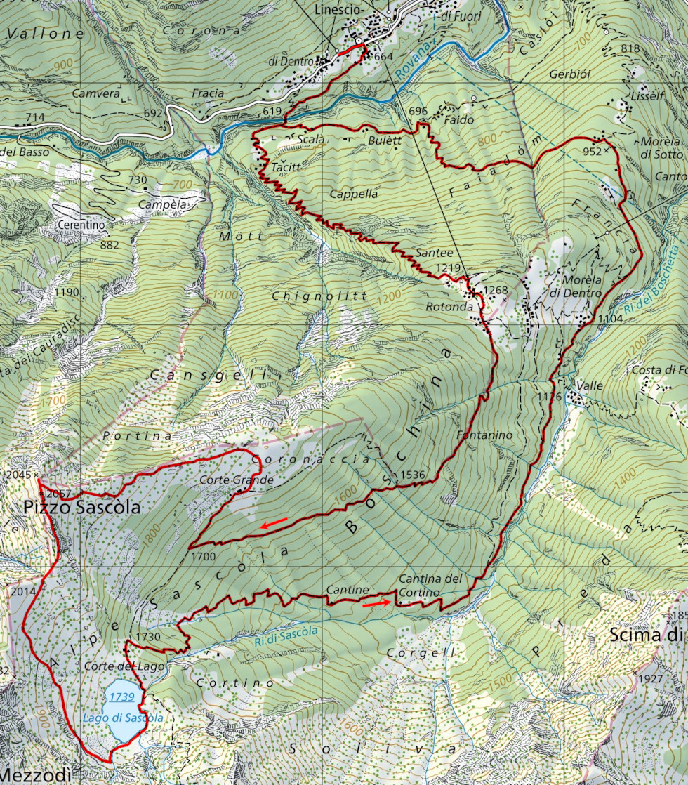
Map of the Path

Summits
Lakes


")


")


")


Comments (0)