
Poncione d'Arzo
Information
| Date: | 15 February 2020 |
| Maximum height: | 1017 m |
| Difference in height: | 380 m |
| Length: | 5 km |
| Kilometers effort: | 10 kmef |
| Duration: | 2 hours |
| For the following peak, there are other variants of the ascent: | Poncione d'Arzo |
Difficulties (Automatic translation in english)

|
All along the route (some T3 passages along the last 100 metres). |
Comment (Automatic translation in english)
Today I return to Poncione d'Arzo, this time from the north side. Climbing from this side has the advantage of a smaller difference in altitude (380 metres against the 500 metres on the south side) but has the disadvantage of being on the shady side of the mountain (at least 800 metres above sea level). It is therefore better to avoid this climb in the colder months.
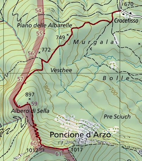
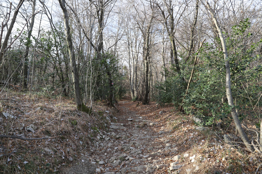
The departure is in Crocefisso, where there is a bus stop. From here you start climbing towards south-west along a dirt road. Towards 800 meters above sea level the road becomes a path that continues to climb along the border line to the Albero di Sella. Here, after a short descent, you start to climb seriously for the last 100 metres of altitude difference. The path was once used by the border guards and climbs in a zig-zag pattern along a fairly steep slope. In some stretches it is a bit ruined (T3 passages) and in winter you might even find ice on it. On the other side of the border there is another path that climbs to the summit. It is the one used by the Italian guards, but in the end it is no better than the Swiss one.
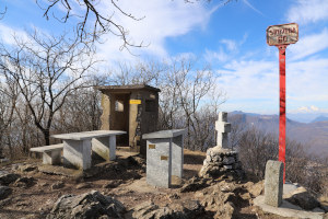
When you finally reach the western peak of Poncione, an easy flat path leads to the eastern peak, the highest.
For the return, follow the same path as the outward route.
Water (Automatic translation in english)
Even on this side of the Poncione there is no water.
Map of the Path

Summits


Comments (0)