
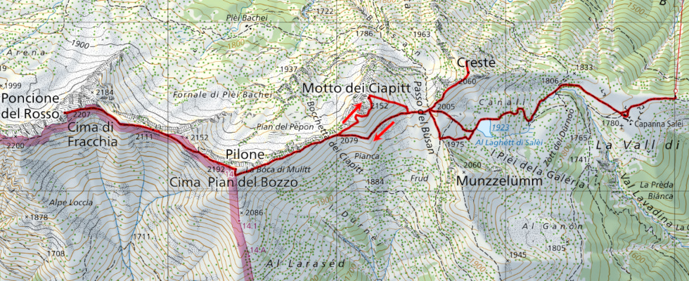
Poncione del Rosso, Pilone, Motto dei Ciapitt e Creste
Information
| Date: | 17 June 2025 |
| Maximum height: | 2207 m |
| Difference in height: | 790 m |
| Length: | 10 km |
| Kilometers effort: | 20.5 kmef |
| Duration: | 5 hours |
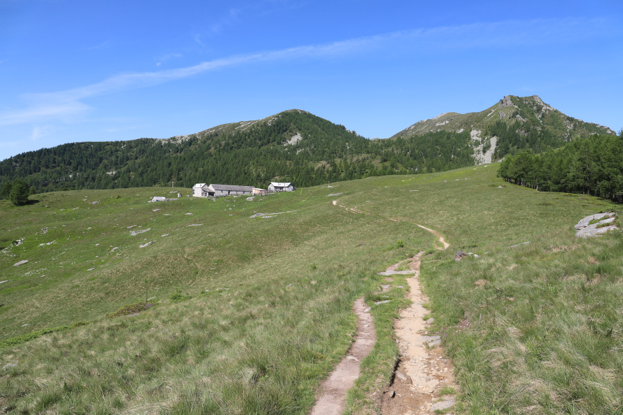
| Huts reached: | Capanna Salei |
| Lakes reached: | Laghetto dei Saléi |
Difficulties (Automatic translation in english)

|
From Capanna Salei to Passo del Bùsan. |

|
From the pass to Pilone (with some T3 passages). |

|
From Pilone to Poncione del Rosso (with some T3+ passages but also many T2+ sections). |
|
|
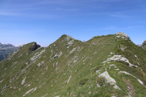
The climb to Motto dei Ciapitt and then to Creste (with some T3 passages). |
Comment (Automatic translation in english)
Twelve years after my last visit to the Laghetto dei Salei area, I return today to climb some of the peaks in the region. This time, however, to save time, I take the cable car from the Vergeletto Valley (20 francs return).
Once I reach the arrival station, I start walking towards Capanna Salei and then climb up to Laghetto dei Salei. I then continue to Passo del Bùsan where, to the left, the path climbs up to Pilone. Climbing up, without too much difficulty, I reach the summit where I stop for a moment to take a break.
The next peak I want to reach is Poncione del Rosso, located along the ridge that continues westwards. I descend in this direction, following a faint trail that disappears from time to time. In some places, there are also small scree slopes to cross. When I reach the point at an altitude of 2111 metres, I start climbing again until I reach the summit of Poncione del Rosso, where I stop to eat.
After the break, I retrace the entire ridge to Pilone, after which I descend to Bocchetta di Ciapitt. Now the third peak of the day awaits me, Motto dei Ciapitt. To reach its summit, I climb along the ridge towards the north-east, which is grassy in the first part but towards the summit has an easy scree slope to cross. I then descend directly and without any particular difficulty back to Passo del Bùsan. I then climb up to the ridges and, after turning back, descend to Capanna Salei, where I take the cable car back to my starting point.
Water (Automatic translation in english)
There is a fountain just above Capanna Salei and then the river, whose water comes from Laghetto dei Salei. Finally, I found a spring 40 metres south-southwest of Passo del Bùsan.
Map of the Path

Summits
Huts
Lakes


Comments (0)