
Sasso Lanzone e Cima di Garina
Information
| Date: | 22 July 2022 |
| Maximum height: | 2826 m |
| Positive difference in height: | 980 m |
| Negative difference in height: | 1270 m |
| Length: | 10.5 km |
| Kilometers effort: | 24.5 kmef |
| Duration: | 7 hours |
| Huts reached: | Capanna Bovarina |
| Lakes reached: | Lago Retico |
| For the following peak, there are other variants of the ascent: | Cima di Garina |
Difficulties (Automatic translation in english)

|
From Pian Geirett to the Pass d'Uffiern (with some T4 passages where there are chains). |
|
|
From the Pass d'Uffiern to the altitude of 2750 metres. |

|
From the altitude of 2750 metres to the summit of Sasso Lanzone and then to the Cima di Garina. |
|
|
The descent from the Cima di Garina to the path at the altitude of about 2600 metres. |

|
From the altitude of 2600 metres to the Rhaetian Lake and finally to the parking area in Predasca. |
Comment (Automatic translation in english)
I had long wanted to walk the Ibex Trail above Campo Blenio and today the opportunity presented itself.
First we drive up to the parking area at Alpe di Predasca where we leave one car. We then descend with the other to Ghirone where we board the bus that will take us to Pian Geirett.
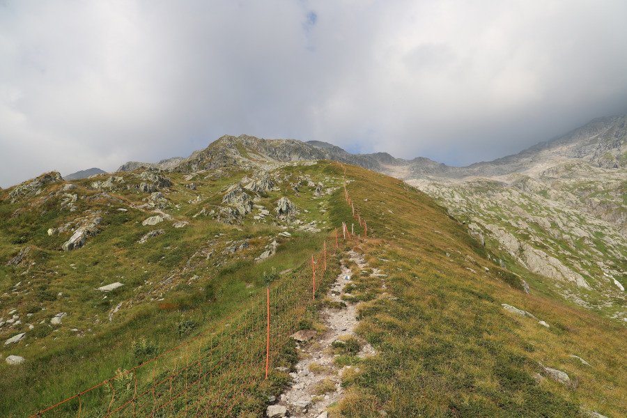
We then start walking, following the path up to the Pass d'Uffiern. A few years ago the trail was moved further north, but on some national maps the change is still not visible. Now the route passes the 2465 metre high point where there are some sections between the rocks where chains have been laid to hold on. Nothing too difficult however.
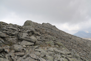
Having reached the pass, we begin to climb towards Sasso Lanzone following the white and blue signs. Towards an altitude of 2750 metres the track becomes more rocky and we continue along the ridge, staying a few metres on the right-hand side. When there are now only 100 metres left to reach the summit at an altitude of 2826 metres, we have a surprise. The path immediately descends to the left instead of continuing as indicated on the map. For some obscure reason on the old maps the path was indicated correctly while on the new ones it has been shifted incorrectly. We still try to continue towards the summit but after about 70 metres we have to stop because then the ridge becomes sharp and too challenging.
Back on the path again, we then start to descend towards the Lago Retico. Given its proximity to the Cima di Garina, the temptation is too strong and we decide to reach it. At around 2690 metres, we then leave the path and continue in its direction. Having reached the southern slope, there are only about thirty metres to go and we are finally at the summit.
For the descent, we follow the entire south ridge until we return to the path previously abandoned. We follow it as far as the Lago Retico and continue towards the Capanna Bovarina. The stretch down from the lake is one of the most ruined in all of Ticino and in many places has been carved out by water to form channels. It is often easier to walk through the grass than to follow the path. Once we reach the river, the path improves and following it we arrive at the Capanna Bovarina where we stop for a moment to have a drink. We finally descend to Predasca where our excursion ends.
Water (Automatic translation in english)
There is a river that descends to the Rhaetian Lake from the east and then a fountain at the Bovarina Hut.
Map of the Path
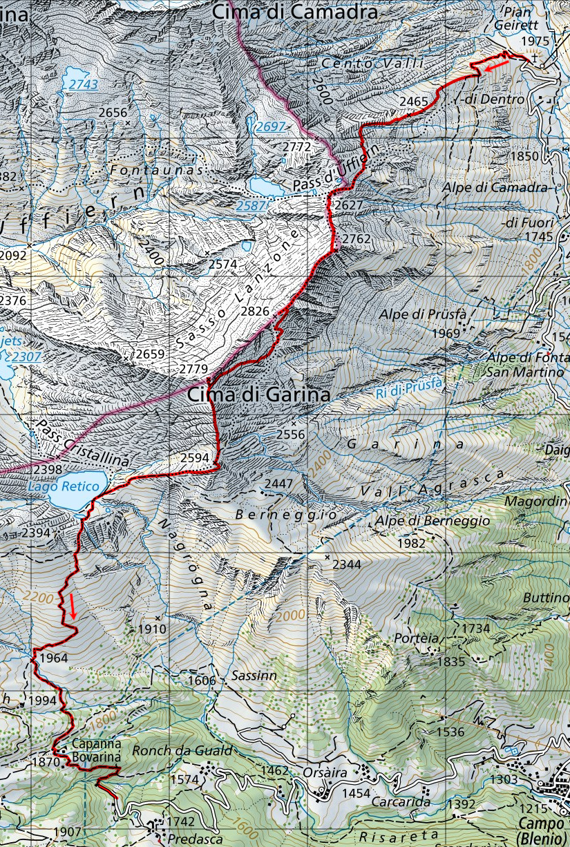

Summits
Huts
Lakes


")

")


")


")


Comments (0)