
Selva Secca e Sorgente del Brenno

Information
| Date: | 24 June 2012 |
| Maximum height: | 1940 m |
| Difference in height: | 260 m |
| Length: | 9 km |
| Kilometers effort: | 12.4 kmef |
| Duration: | 3 hours |
Difficulties (Automatic translation in english)

|
From Acquacalda to Lareccio. |

|
From Lareccio to Alpe Pertusio (except the shortcut T2) and from there to Alpe Casaccia. |
|
|
From Alpe Casaccia to Acquacalda. |
Comment (Automatic translation in english)
Reached the locality of Acquacalda, where there is the Pro Natura Lucomagno Center, we begin to walk along the path that leads from the campsite to the west in the locality of Selva Secca.
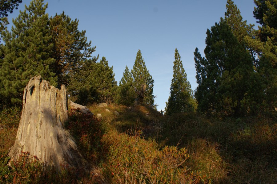
Here we find a forest reserve with a very ancient stone pine forest that has old specimens of even 3 centuries. It also easily happens to run into the hazelnut, a bird that has made the seeds of pine cones one of its main foods and that here is particularly at ease.
After the Selva Secca we reach the town of Lareccio where the path, now become a road, begins to descend towards the north reaching the Alpe Gana and the river Brenno. After crossing the river, we decide to cut directly to the north to save a bit of walking, but it is also possible to follow the road that leads to Alpe Casaccia and then turn left.
Finally we arrive at Alpe Pertusio where, right under a rock, there is the source of Brenno. The area of Lucomagno is in fact very karst and has many sinkholes and sinkholes where streams disappear into the subsoil and then reappear, as in this case, from a source.
Return to the Alpe Casaccia and this time we continue straight, along the river, until returning to Acquacalda.
Water (Automatic translation in english)
There is a fountain at Stabbio Nuovo and then of course there is the Brenno river.
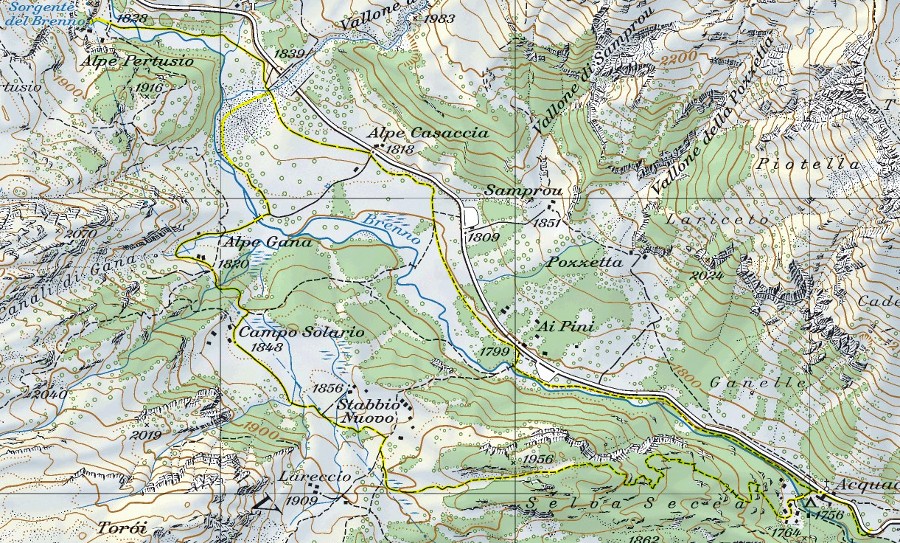
Map of the Path

Other


Comments (0)