
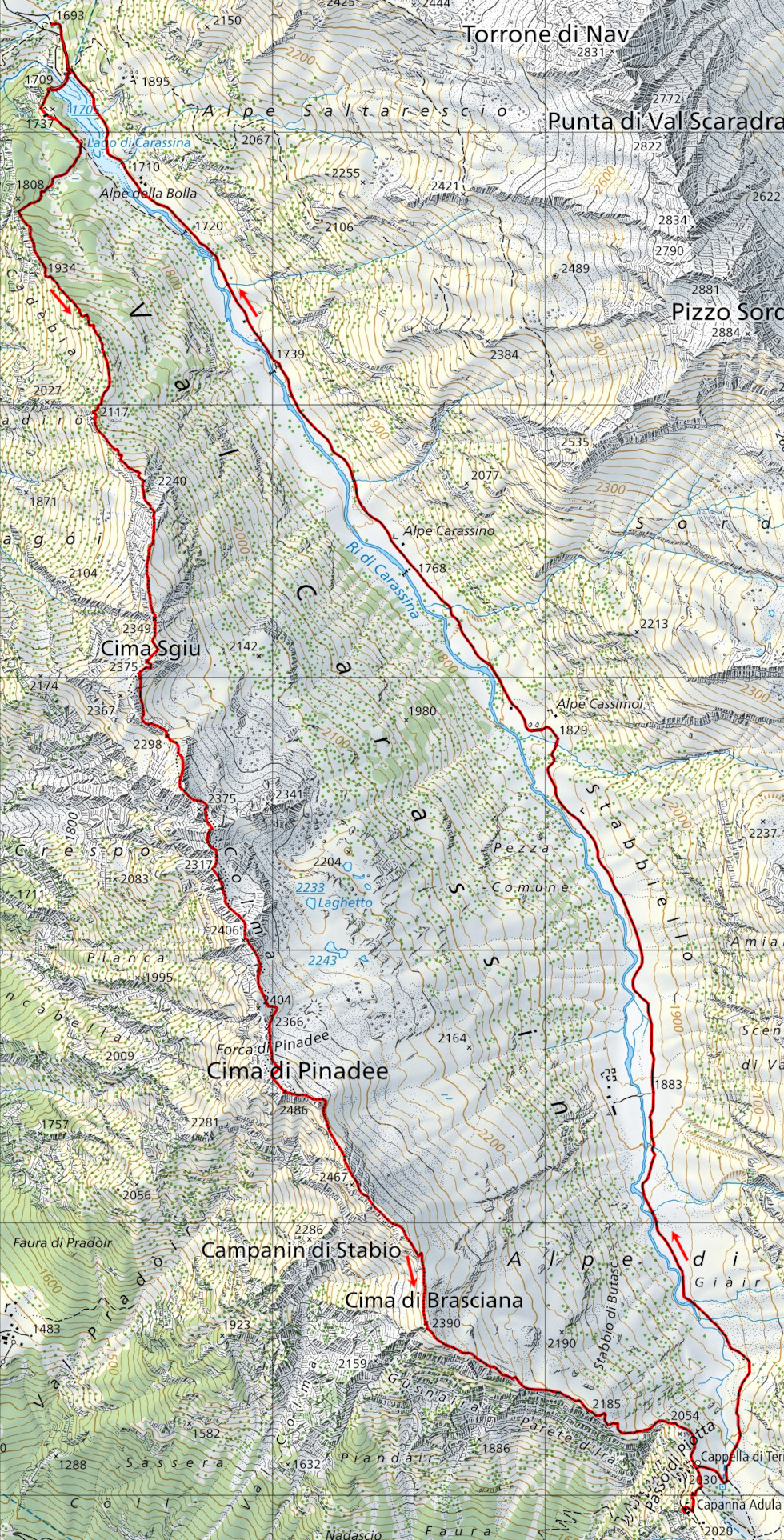
Via Alta della Val Carassino
Information
| Date: | 22 September 2022 |
| Maximum height: | 2486 m |
| Difference in height: | 1240 m |
| Length: | 15 km |
| Kilometers effort: | 31.5 kmef |
| Duration: | 9 hours |
| Huts reached: | Capanna Adula CAS |
Difficulties (Automatic translation in english)

|
From the Carassino dam to the 2240 metre mark (with some T3 / T4 passages). |

|
From the altitude of 2240 metres up to Cima Sgiu (with grade II climbing passages). |

|
From Cima Sgiu up to the 2406 metre peak (with some grade II climbing passages). |
|
|
From the previous summit to the Forca di Pinadee (with grade II passages 100 metres after the summit). |
|
|
From the Forca di Pinadee to the Cima di Pinadee (with 1 grade II passage just before the summit). |

|
From Cima di Pinadee to Cima di Brasciana and then up to Passo di Piotta. |

|
From the Piotta Pass to the Capanna Adula CAS and then all the way to the Carassino dam. |
Comment (Automatic translation in english)
I have been wanting to do the Via Alta in the Val Carassino for some time and today the time has finally come. This route, opened in 2013, runs along the west ridge of the valley and allows you to reach the Capanna Adula CAS by an alternative route to the valley floor. It is possible to walk it in both directions, but for greater safety, I preferred to follow the north-south direction so as to do the more difficult sections immediately in the morning and leave the long Val Carassino for the return.
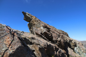
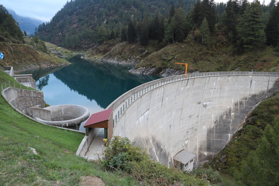
The start of this trip is just before Lake Carassina where there are several parking areas. I then set off along the road into the valley and follow the path across the crown of the dam. On the other side, I continue for about 300 metres and then begin to climb through the woods in the direction of the crest. Once I reach it, I follow it in a southerly direction, without any particular problems, up to an altitude of 2240 metres. At that point the most difficult part of the entire trip begins, with very scenic and at times somewhat exposed sections. The difficulty reaches T5 with grade II climbing passages. Many points, however, have been secured with metal cables or handholds, which help a lot to improve safety. The most difficult section, perhaps of the entire route, is located at an altitude of 2274 metres (coordinates 2'717'562.2, 1'154'594.4) where a somewhat sharp ridge (see photo) with a large precipice to the west and a somewhat less impressive one to the east must be overcome. Further on, there are more ascents and descents on rock, but somewhat less demanding than the previous one. I arrive in this way at Cima Sgiu, the first of the three peaks I will reach today.
At this point, a long, slightly less difficult (T4) and less exposed section begins, which leads up to the summit at 2406 metres. The descent to the Forca di Pinadee, on the other hand, presents a last demanding section (still T5 with grade II climbing passages) towards an altitude of 2370 metres (coordinates 2'717'944, 1'152'972) in which it is necessary to cross a somewhat sharp ridge where, on the eastern side, there are, as always, handholds and metal cables. Now all that remains for me to do is to climb one last scree slope and arrive on the Pinadee summit where I can finally take a slightly longer break. On the other side the ridge is a little easier and following it I reach the Cima di Brasciana. I then continue along the path, now quite visible, to the Piotta Pass and then descend for a moment to the Capanna Adula CAS, as I have not seen it for many years. Back in the Val Carassino, I descend it all the way back to the starting point.
Water (Automatic translation in english)
There is a fountain at the Capanna Adula CAS and then a few more along the Val Carassino.
Map of the Path

Summits
Huts


")

")


")


")


")


")


Comments (0)