
Vogelberg
Information
| Date: | 20 - 21 August 2023 |
| Maximum height: | 3217 m |
| Difference in height: | 2030 m |
| Length: | 15.5 km |
| Kilometers effort: | 42.5 kmef |
| Duration: | 12 hours |
Difficulties (Automatic translation in english)

|
From Fontané to the fork at the altitude of 2063 metres (with some T2+ sections after Piano di Pena). |

|
From the altitude of 2063 metres to the altitude of 2770 metres (with some T3 passages after the altitude of 2360 metres). |

|
From the altitude of 2770 metres to the altitude of 3000 metres (with some T3+ passages). |

|
From the altitude of 3000 metres to the altitude of 3100 metres, where it begins the ascent towards the gully. |

|
From the altitude of 3100 metres to the summit of the Vogelberg via the gully where the rock is unstable. |
Comment (Automatic translation in english)
After having climbed Pizzo Cramorino last year, this year I want to reach the nearby Vogelberg, the second highest mountain in Val Malvaglia after Adula. In order not to follow the same itinerary as last time, I decide to pass through the valley up to the Giumello glacier. Since this excursion will require more than 2000 metres of altitude gain, I take my tent and sleeping bag with me so that I can sleep along the way. The weight of the rucksack is therefore higher than usual.
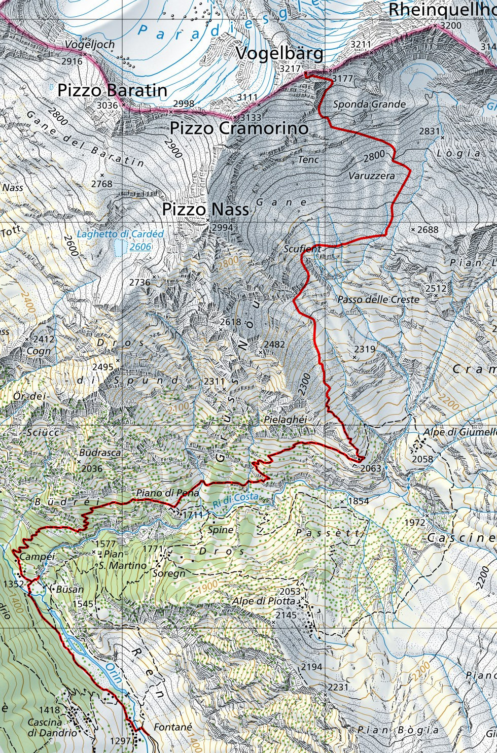
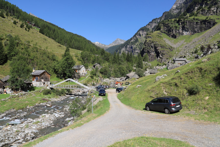
Having reached the village of Fontané, at the bottom of the Val Malvaglia, I start to climb, following the path along the valley floor. Having crossed the bridge at an altitude of 1352 metres, I go for a moment to see the Ri di Costa waterfall and then continue on to Campéi. At that point the path becomes a little steeper and following it I reach the Piano di Pena without any problems. On the following stretch, however, until the fork at an altitude of 2063 metres, there is some vegetation along the way and the track is not always clearly visible. Having reached the fork, I leave the path that leads to Alpe di Giumello to follow the track that climbs to the left. Up to an altitude of 2220 metres it is quite visible, then it disappears. In its place, however, white and blue signs appear, which, as I later discover, indicate one of the paths to follow to exit the new Via Alta Crio, not yet inaugurated. Unfortunately, however, the signs are not always easy to see because they were made for those descending and not for those ascending, and they are often only visible after passing them. Following them I reach a plateau at an altitude of 2360 metres where I pitch my tent and spend the night.
The next day I start climbing again, following the white and blue signs. I have left my tent and sleeping bag behind a rock and can now finally walk lighter. The terrain is now a little more stony but you can still continue without much difficulty. Every now and then, a slight trace even appears.
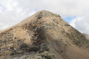
At an altitude of 2770 metres, the blue and white signs continue towards the Giumello glacier while I turn left and start to climb towards the Vogelberg. Crossing the slope full of scree, I reach two rocky jumps, one at an altitude of 2900 metres and one at 3000 metres, which I pass without any problems (see photo). I then continue northwards until I reach the base of the ridge that connects the Vogelberg with the Rheinquellhorn. At this point, there are two ways up: either ascend towards the summit, which is listed at 3211 metres, or climb the gully on the left that leads directly to the summit. I choose the latter route because it seems the easiest. The gully, however, proves to be very tiring due to the unstable terrain and the continuous landslides of the rock underfoot. After this challenging section I finally reach the top of the Vogelberg where I find a small stone cairn waiting for me.
After my lunch break, I start to descend again by the same route as before. I had better not lose too much time because now I still have more than 2000 metres of descent left to do. Back on the plateau at an altitude of 2360 metres, I retrieve my tent and sleeping bag and continue back to the starting point.
Water (Automatic translation in english)
There is a fountain shortly after Fontané at the altitude of 1330 metres and then a basin with a water pipe near the fork at the altitude of 2063 metres. Then there are a few more rivers between 2600 and 2770 metres altitude.
Map of the Path

Summits


")

")

")
")
")
")
")
")


Comments (0)