
Cima di Gana Rossa
Information
| Date: | 2 October 2023 |
| Maximum height: | 2786 m |
| Difference in height: | 1110 m |
| Length: | 10.5 km |
| Kilometers effort: | 25.3 kmef |
| Duration: | 7 hours |
Difficulties (Automatic translation in english)

|
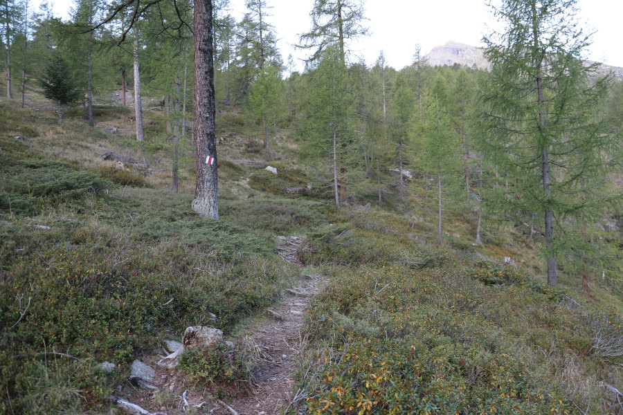
From the parking area in Cusiè to Alpe di Sceru. |

|
From Alpe di Sceru to the altitude of 2420 metres (with some T3 passages in the first section along the trail). |

|
From the altitude of 2420 metres to the altitude of 2530 metres. |

|
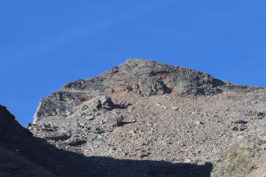
From the altitude of 2530 metres to the Cima di Gana Rossa (some sections only T3). |
Comment (Automatic translation in english)
After having gone up the Vogelberg in August, today I return to Val Malvaglia again, but this time to climb the Cima di Gana Rossa.
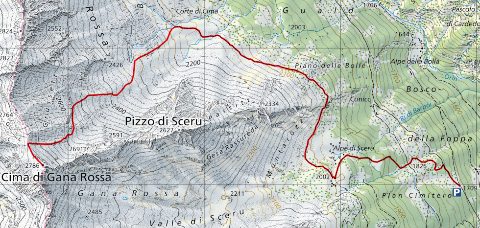
I start by reaching the village of Cusiè, where there is a large car park. I then start walking following the road that leads to Alpe di Pozzo and then, after about 200 metres, take the path that climbs to the left until I reach Alpe di Sceru. At that point, I continue on to Corte di Cima along a path that is a little less beautiful than the previous one and with a few more stones on the way. Having arrived at an altitude of 2190 metres, I leave the official path and begin to climb southwest along slopes strewn with blueberries. I thus enter the valley that rises to the Cima di Gana Rossa. I climb it all, staying as far as possible on the north side where the terrain is a little easier. On that side, in fact, up to an altitude of 2420 metres, you can walk on grass. Afterwards there are boulders, but they are never too difficult.
I arrive in this way at the pass at an altitude of 2740 metres. At that point, following the easy, wide ridge to the south, I soon reach Cima di Gana Rossa. The view is stupendous, especially in the direction of Adula, where numerous peaks exceeding 3000 metres can be seen. While I am intent on admiring the landscape, I am also lucky enough to catch a glimpse of a griffon vulture flying in the sky above me.
After my lunch break, I start to descend again, and following the same route as in the morning, I return to the car park in Cusiè.
Water (Automatic translation in english)
There are no real fountains but there is a water pipe southeast of Alpe di Sceru, at an altitude of 1978 metres. There are also several streams flowing at the alp. Then there is the river that crosses at altitude 2143 metres, south of the Corte di Cima.
Map of the Path

Summits


Comments (0)