
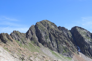
Cima di Lago dal Canale del Becco
Information
| Date: | 18 July 2025 |
| Maximum height: | 2832 m |
| Positive difference in height: | 1170 m |
| Negative difference in height: | 2080 m |
| Length: | 22.5 km |
| Kilometers effort: | 41.1 kmef |
| Duration: | 9 hours and 30 minutes |
| Huts reached: | Capanna Cristallina |
| Capanna Basodino |
| Lakes reached: | Lago Bianco |
| Laghetto del Passo di Cristallina | |
| Lago Sfundau |
Difficulties (Automatic translation in english)

|
From Robièi to the dam of Lake Cavagnöö. |

|
From the dam to the base of the Canale del Becco at the altitude of 2590 metres (with some T4 passages). |

|
The ascent of the couloir to the altitude of about 2680 metres (with grade II climbing passages). |

|
From the altitude of 2680 metres to Cima di Lago (with some T4 passages). |
|
|
The descent from Cima di Lago to the start of the trail at the altitude of 2700 metres. |

|
The descent to Capanna Cristallina and then to the road near Lago Bianco (with some T3 passages). |

|
The trail that descends from Robièi to San Carlo (T1 the section on the road). |
Comment (Automatic translation in english)
Cima di Lago is a mountain located at the end of Val Bavona, on the border with Val Bedretto. The easiest route up is the one that starts from Capanna Cristallina and reaches the summit from the north-east. However, I intend to climb following a section of the Via Alta Idra and pass through the Canale del Becco. This variant is certainly more difficult but also more interesting.
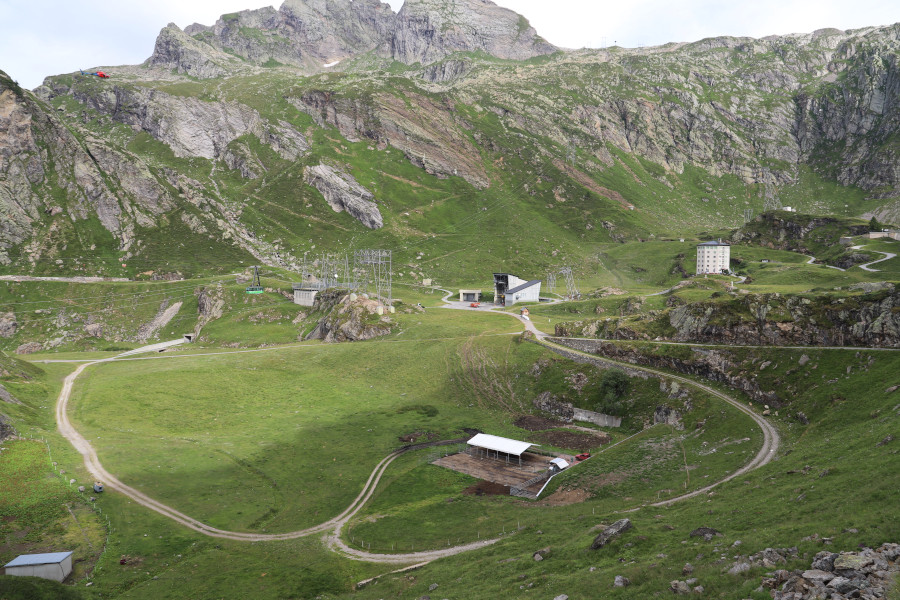
First, I take the cable car from San Carlo to Robièi (19 Swiss francs one way; 24 Swiss francs return), then I start walking along the road that climbs to Lago Bianco and continues to the dam at Lago dei Cavagnöö. I then take the path that climbs towards Passo Grandinagia, which between 2,350 metres and 2,390 metres is somewhat panoramic and slightly exposed. At an altitude of 2,577 metres, I reach the Via Alta Idra, which comes from Capanna Corno-Gries and heads towards Capanna Cristallina. I start to follow it to the right, slightly downhill, until I reach the famous Canale del Becco after a kilometre. Seeing it from a distance, it seems impossible that there is a path that climbs it. However, along the 70 metres of elevation gain of the canal, there is a track that climbs, equipped with cables and metal handles to hold on to. However, a certain amount of strength is required because in some places you have to pull yourself up. Obviously, you must not be afraid of heights because the route is very exposed and aerial.
Once out of the channel, there is still a small section of ridge to climb, equipped with chains, after which the most difficult part is over. You then continue for about 60 metres eastwards until you pass a ridge where the route turns sharply northwards. At that point, the exposed part is over and the path continues without great difficulty towards Capanna Cristallina. I follow it for about 100 metres and then leave it and head towards Cima di Lago. After crossing an easy scree slope, I reach the summit, where I finally stop to eat.
For the return journey, I choose to descend via the normal route, heading north-east, until I reach the path at an altitude of 2,700 metres. I follow it to Capanna Cristallina, then descend to Lago Sfundau and then to Lago Bianco. I then follow the road back to Robièi, where unfortunately I arrive too late to catch the cable car. I therefore have to follow the long and endless path that takes me back to San Carlo, where this trip ends.
Water (Automatic translation in english)
There is a fountain in Robièi, one near the Capanna Basodino mountain hut and, on the way back, one in the cable car car park. There are also two streams near the road in the Cortino area and finally another one about 400 metres before the Canale del Becco. There is nothing else until you reach Lago Bianco, at an altitude of 2342 metres, where there is a small stream.
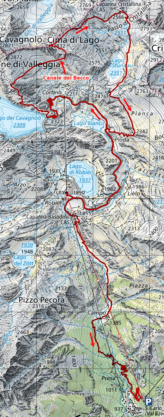
Map of the Path

Summits
Huts
Lakes


")


")

")


Comments (0)