
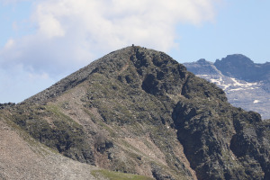
Cima di Piancabella
Information
| Date: | 24 June 2025 |
| Maximum height: | 2670 m |
| Difference in height: | 980 m |
| Length: | 9 km |
| Kilometers effort: | 22 kmef |
| Duration: | 6 hours and 30 minutes |
Difficulties (Automatic translation in english)

|
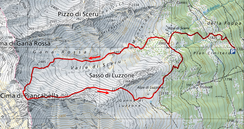
From Cusiè to Alpe di Sceru. |

|
From the alp to the altitude of 2470 metres (with some T3 passages in the last section). |

|
From the altitude of 2,470 metres to the Cima di Piancabella peak. |

|
The descent from the summit to the pass at the altitude of 2312 metres (with some T4 passages). |
|
|
From the pass to Alpe di Luzzone and then to Alpe di Sceru (T2 section on the trail). |
Comment (Automatic translation in english)
Today's trip is to Cima di Piancabella, climbing up from Val Malvaglia.
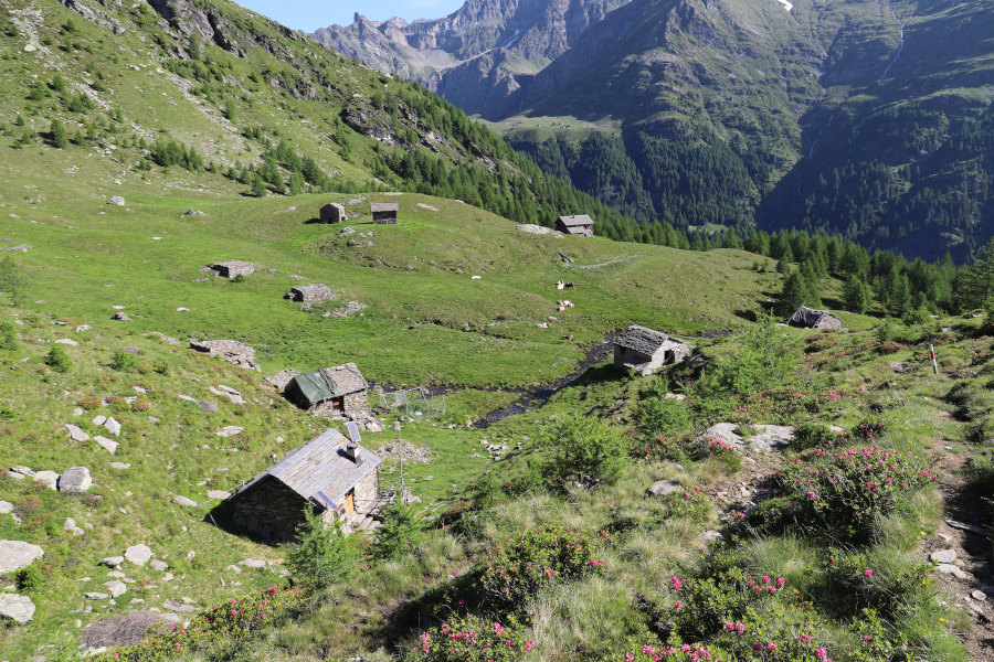
After reaching the car park just past Cusiè, I start walking along the road that leads to Alpe di Pozzo. I then take the path that climbs up to the left and leads me to Alpe di Sceru. Just above the alp, I leave the path and begin to climb into the Valle di Sceru among larch trees and rhododendrons. At an altitude of around 2,200 metres, a faint trail appears, which I follow to an altitude of around 2,400 metres. At this point, the terrain becomes rockier, but the rocks are fairly small and easy to climb over.
At an altitude of around 2600 metres, there are two routes to follow. Either head directly for the summit or go west and climb first onto the north ridge of Cima di Piancabella. I discard the first option because the rocks on that side seem a little larger than those to the west. I therefore climb this latter part and reach the ridge about 130 metres from the pass at an altitude of 2,612 metres. I then turn left to climb the last 40 metres of elevation gain to reach the summit. As the ridge becomes a little rocky as it climbs, I go around it on the right (Blenio Valley side) where there is a track that takes me to the summit. On Cima di Piancabella there is a large cairn with a summit book inside.
After my lunch break, I begin to descend eastwards with the idea of reaching Alpe di Luzzone via the pass at an altitude of 2312 metres. I descend, keeping just to the left of the ridge along terrain that is a little more unstable than that of the ascent. When I reach the pass, Sasso di Luzzone stands out right in front of me with its steep and impressive walls.
I then descend to Alpe di Luzzone, where only a few buildings remain standing, after which I take the path that leads me back to Alpe di Sceru. After replenishing my water supplies, I descend again to the car park where I end my trip.
Water (Automatic translation in english)
There are several streams at Alpe di Sceru, both in the northern part (altitude 1,963 metres) and in the southern part (altitude 1,994 metres). There are also a few others in Valle di Sceru, the last of which is accessible up to an altitude of approximately 2,300 metres. On my return, I did not find anything else until I reached Alpe di Sceru again.
Map of the Path

Summits


Comments (0)