
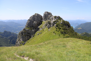
Il Torrione, Cima di Fojorina, Cima Mosè e Cima dell'Oress
Information
| Date: | 7 July 2023 |
| Maximum height: | 1810 m |
| Difference in height: | 930 m |
| Length: | 13 km |
| Kilometers effort: | 25.4 kmef |
| Duration: | 6 hours |
| For the following peak, there are other variants of the ascent: | Cima di Fojorina |
Difficulties (Automatic translation in english)

|
From Cimadera up to Bocchetta di San Bernardo (T1 the road section up to Cima della Pianca). |

|
From the Bocchetta di San Bernardo to the base of the Torrione. |

|
The climb up the Torrione (with a grade II climbing passage equipped with a rope). |
|
|
From the Torrione up to the Cima di Fojorina and then down to the pass at the altitude of 1715 metres. |
|
|
From the pass at the altitude of 1715 metres to Cimadera (T1 the section on the road from 1400 metres down). |
|
|
The ascent to the Cima Mosè (T3 the last few metres). |
Comment (Automatic translation in english)
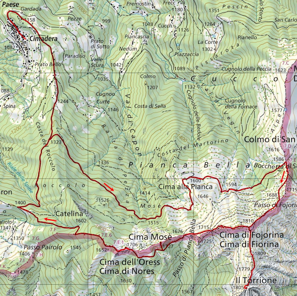
Today I am returning to the Cima di Fojorina area to climb some surrounding mountains.
After reaching Cimadera, in Val Colla, I walk along the road, which is closed to traffic, that goes up to Cima della Pianca. I then continue to Bocchetta di San Bernardo, where I take the path that climbs to Passo di Fojorina. I then continue to follow the ridge towards Cima di Fojorina but, 80 metres before reaching the summit, I turn left and continue along a path through a pine forest. I go around the summit elevation of 1809 metres on the right and reach the base of the Torrione on the north-east side. I then climb a short gully, about 6 metres long, in which there is a rope to attach to (grade II climbing). Having passed this section, the most difficult part is over. I round the Torrione on the west side and then climb a grassy slope and am at the summit. The entire route is marked with red and white signs.
After a short break, I descend back down the mountain and retrace the ridge that I had done before until I reach the Cima di Fojorina. Here I stop for a little longer to eat something.
I then descend the west ridge until I reach Passo di Pianca Bella and then continue along the path that leads to my next destination, Cima Mosè. The east ridge of this peak seemed too dirty, full of bushes and pine trees. I therefore decide to reach the south slope and climb from that side. I would say that this is the best solution. The first section is quite clean and only in the last 10 metres are there some pine trees to cross.
After reaching the summit, I go back down to the path and continue on to the last mountain of this trip: the Cima dell'Oress. This is the easiest of all to reach. There is only an easy meadow to climb and after 20 metres of ascent I am at the summit. I then descend on the other side and continue along the path that leads to the Capanna Pairolo. Having arrived at the fork at an altitude of 1400 metres, I take the road that descends to the right and return to Cimadera.
Water (Automatic translation in english)
There are a few fountains up to an altitude of 1244 metres and then on the way back I found one more, above the Capanna Pairolo, 100 metres west of the fork at 1400 metres.
Map of the Path

Summits


")


Comments (0)