
Laghi e Pizzo della Cavegna
Information
| Date: | 12 July 2022 |
| Maximum height: | 2281 m |
| Difference in height: | 1260 m |
| Length: | 13 km |
| Kilometers effort: | 29.8 kmef |
| Duration: | 7 hours and 30 minutes |
| Huts reached: | Capanna Alpe d’Arena |
| Lakes reached: | Lago della Cavegna Inferiore |
| Lago della Cavegna Superiore |
Difficulties (Automatic translation in english)

|
From the parking area at the altitude of 1230 metres to Alpe di Porcaresc (T1 the road section). |
|
|
From Alpe di Porcaresc to Lago della Cavegna Inferiore (with some T2+ passages). |

|
From Lago della Cavegna Inferiore to Lago della Cavegna Superiore. |

|
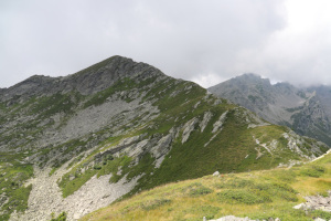
From Lago della Cavegna Superiore to the summit of Pizzo della Cavegna. |
|
|
From the summit of the peak to the lakes via the south (with some T3+ passages where the slope is steeper). |
|
|
From the Alpe di Porcaresc to the Alpe d'Arena hut and then to the parking area. |
Comment (Automatic translation in english)
The Cavegna Lakes are two small lakes located between the Campo Valley and the Vergeletto Valley. To reach them I decided to start from the latter and to climb, while I was at it, Pizzo della Cavegna as well.
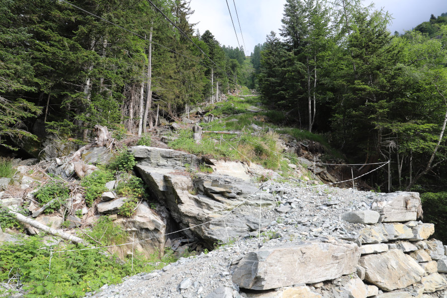
First I reached a clearing, 600 metres before Alpe del Casone, where I left my car. It is useless to go any further, since on the way back I plan to pass by the Capanna Alpe d'Arena. The road in the last 800 metres is quite uneven with several stones on the roadway.
I put on my boots and start walking along the valley floor until I reach an altitude of 1445 metres. At that point I take the slightly steeper path that climbs up to Alpe di Porcaresc and then continues to Passo della Cavegna. Having reached that place I can finally admire Pizzo della Cavegna on my left and, a few metres below me, the first of the two small lakes. I head towards the latter and, after reaching it, begin to climb towards the second small lake located at an altitude of 2041 metres. To ascend to the lace, I continue in the direction of the summit at an altitude of 2157 metres, on which I climb for a moment to take some photos of the lakes. I then walk along the ridge that will take me, without too much difficulty, to my final destination.
For the return trip, I plan to follow another route and descend to the vent at an altitude of 2223 metres. I then walked along the entire south side of Pizzo della Cavegna and then crossed the ridge and descended again to the small lakes. After returning to the Alpe di Porcaresc, I then take the path that leads to the Alpe d'Arena hut and after a final descent I return to the car.
Water (Automatic translation in english)
I found some private fountains at Alpe di Porcaresc and then a free one at the Alpe d'Arena hut. In addition, there are two streams before the 1445 metre altitude point and then a few more between Alpe di Porcaresc and Alpe d'Arena.
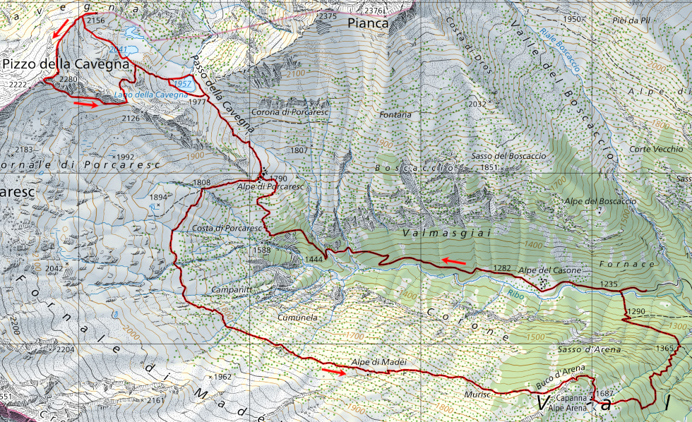
Map of the Path

Summits
Huts
Lakes


Comments (0)