
Marmontana e Cima di Cugn
Information
| Date: | 26 May 2023 |
| Maximum height: | 2315 m |
| Difference in height: | 1420 m |
| Length: | 14 km |
| Kilometers effort: | 32.9 kmef |
| Duration: | 8 hours |
| Huts reached: | Rifugio San Jorio (IT) |
Difficulties (Automatic translation in english)

|
From the bridge at an altitude of 2021 metres to the San Jorio Pass and then to an altitude of 2140 metres south of the Marmontana. |

|
From an altitude of 2140 metres to the top of Marmontana and then the west ridge to an altitude of 2260 metres. |

|
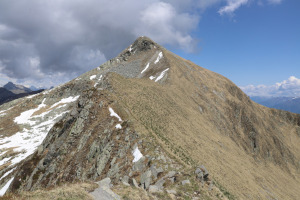
The rest of the ridge to the Cima di Cugn and then the descent to the San Jorio Pass (with some T3 passages). |
Comment (Automatic translation in english)
I have been wanting to climb the Cima di Cugn for a while and now I have decided that the time has come. While I'm at it, however, I will also climb the nearby Marmontana, which is only 700 metres away as the crow flies.
The start is at the bottom of the Morobbia Valley, near the bridge at an altitude of 1021 metres. The section from Carena to the bridge is closed to motorised traffic and therefore must be covered by bicycle or on foot.
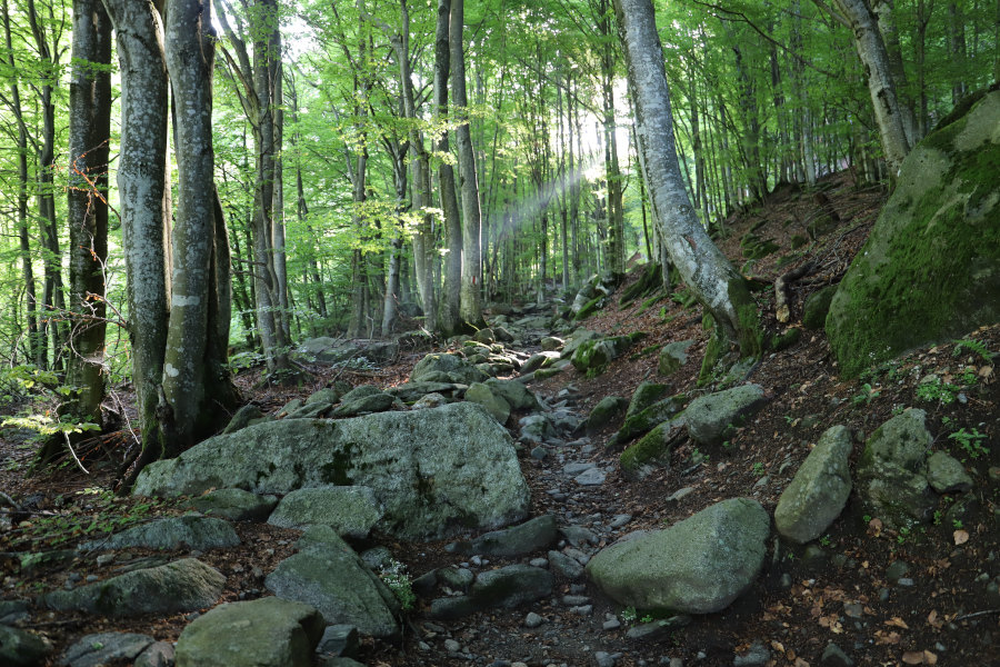
I then start to follow the path that climbs up through the woods towards the east. In the first section, the climb is very gentle but then, towards an altitude of 1400 metres, it becomes steeper. I reach the village of Giggio and continue until I reach the San Jorio Pass. This pass, which connects Switzerland with Italy, was once very popular with traders because it was the most direct route from Bellinzona to Gravedona. Later it was also much used by smugglers, so much so that several barracks of the Guardia di Finanza were built on the Italian side. One of these stands just below the pass and was later converted into the Rifugio San Jorio.
Since the distance is short, I decide to descend for a moment to take a look at the refuge and then take the path on the Italian side that goes up towards the Marmontana. Up to an altitude of 2140 metres, the track climbs gently but then turns left, heading straight up towards the summit, and becomes steeper. Towards an altitude of 2200 metres, the track turns left again to head towards Cima di Cugn. At that point, to shorten the route, I decide to leave the path and cut across the meadows. In a short time, I reach the summit of Marmontana where I find a small stone cairn and a cross.
After my lunch break, I set off again following the ridge westwards where there is a slight trace. After descending to the gap between the two mountains, I climb back up the other side until I reach the Cima di Cugn. I then descend towards the two barracks near the point listed at 2194 metres and a few metres further down I reach the easternmost point of Canton Ticino. I continue walking until I return to the San Jorio Pass and then, since I still have some time left, I make a short ascent southwards until I reach the beautiful little church of San Jorio.
Retracing my steps, I walk back down the path I had walked in the morning until I return to my starting point.
Water (Automatic translation in english)
There are two fountains in Giggio and afterwards nothing. The river at the bottom of the valley is not always easy to reach.
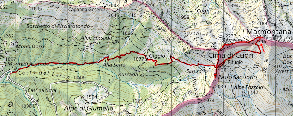
Map of the Path

Summits
Huts


")


Comments (0)