
Monte Bar
Information
| Date: | 3 May 2021 |
| Maximum height: | 1816 m |
| Difference in height: | 780 m |
| Length: | 11 km |
| Kilometers effort: | 21.4 kmef |
| Duration: | 4 hours and 15 minutes |
| Huts reached: | Capanna Monte Bar |
| For the following peak, there are other variants of the ascent: | Monte Bar |
Difficulties (Automatic translation in english)

|
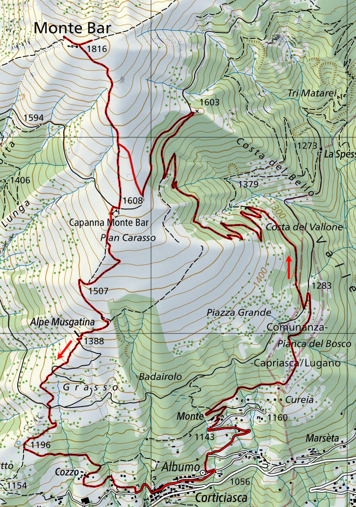
From Corticiasca to the crossroads at the altitude of 1283 metres. |

|
From the crossroads at the altitude of 1283 metres to the top of Monte Bar and back to Corticiasca. |
Comment (Automatic translation in english)
Today I climbed Monte Bar from Corticiasca, a new route that I had not yet walked.
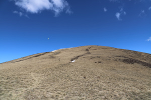
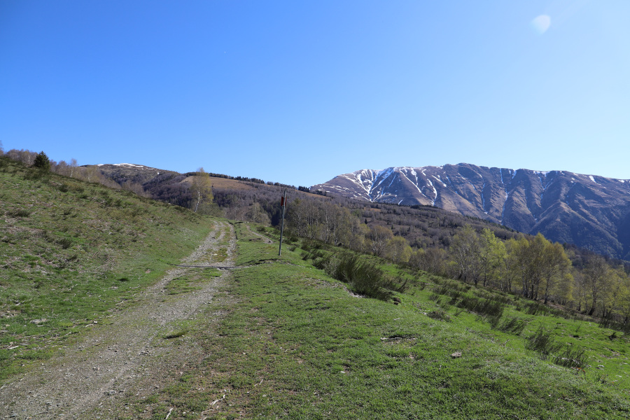
Having reached the church above the village, I start to climb towards Monte and after passing it, I continue in the direction of Pianca del Bosco. This first stretch is mostly on a road and is very easy to walk. When I reach an altitude of 1290 metres, I turn right in the direction of Costa Vallone, along a nice, clean path with little slope. I continue climbing until I reach an altitude of 1603 metres, where I meet the road that leads to the Capanna Monte Bar. I follow it for 500 metres, then I leave it to start climbing towards Monte Bar, along a small path that goes up through the meadows. I follow it for a few hundred metres until I rejoin the path coming from the hut and continue up to the summit.
After a well-deserved break, I start to descend towards the Monte Bar hut. Once reached the hut, instead of going back to the same path taken uphill, I prefer to try to go down towards Alpe Musgatina. When I reach the alpe, I continue to descend following the path, even if, as an alternative, it is also possible to follow the road. I reach the crossroads at an altitude of 1260 metres, where there are benches and a fountain. From the crossroads I continue to descend and at an altitude of 1196 metres I turn left. I arrive in a short time at Cozzo and then again at Corticiasca.
The path taken on the way back is a bit steeper than the one taken on the way up, but it is also shorter and faster.
Water (Automatic translation in english)
I found a pipe from which enough water gushed out near the Costa del Vallone. On the way back, I found a fountain at the fork at an altitude of 1260 metres. There were several other fountains around, but they were all closed, including the one at the hut.
Map of the Path

Summits
Huts


Comments (0)