
Monte Generoso
Information
| Date: | 23 May 2010 |
| Maximum height: | 1701.3 m |
| Difference in height: | 1430 m |
| Length: | 13.3 km |
| Kilometers effort: | 32.3 kmef |
| Duration: | 7 hours and 30 minutes |
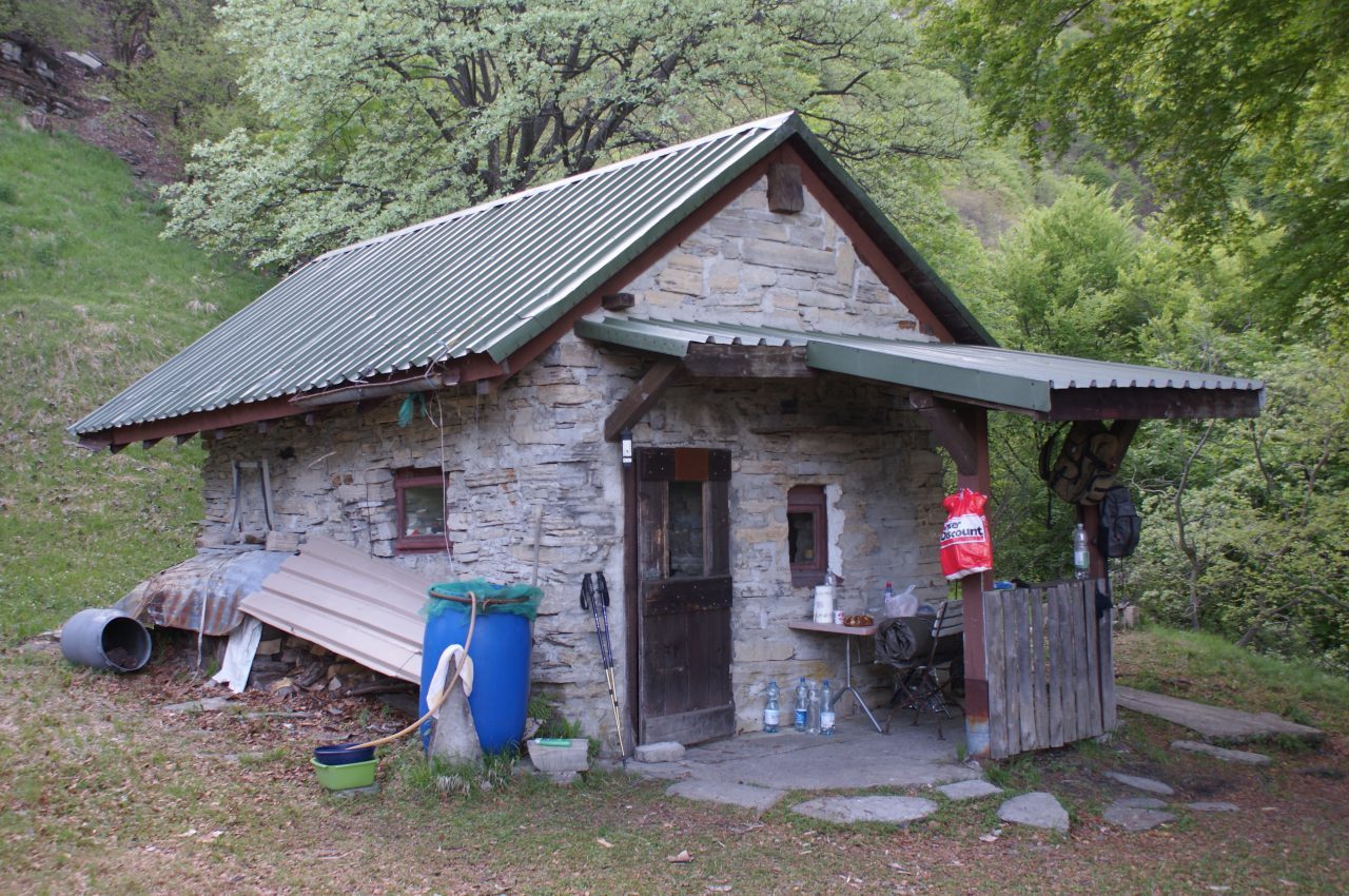
| Huts reached: | Rifugio Perostabbio |
| For the following peak, there are other variants of the ascent: | Monte Generoso |
Difficulties (Automatic translation in english)

|
From Rovio to the Prato di Pioda. |

|
From Prato di Pioda to Rifugio Perostabbio and then up to the altitude of 1380 metres. |

|
From the altitude of 1380 metres to the first ropes at 1580 metres. |

|
From the altitude of 1580 metres to the pass at the altitude of 1652 metres. |

|
From the altitude of 1652 metres to the summit of Monte Generoso (direct route). |

|
From the summit of Monte Generoso to Rovio via the Cima dei Torrioni. |
Comment (Automatic translation in english)
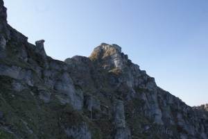
This tour describes the famous route of the variant that goes from Perostabbio directly to Monte Generoso. You can leave the car just under Rovio, in a large parking lot. From there you cross the village and you start to climb along a dirt road until the Chapel of Soldino that you pass to the left. Then continue on the road until the bridge under the Prato di Pioda, after which you begin to climb along an unmarked path. At 700 meters the path is divided into two variants. One, the official one seen some old white-red signs present, zig-zag salt and is sometimes quite steep. Unfortunately it is full of fallen trees that oblige many diversions but it is still the best to follow when climbing. The other variant is a little less visible, rises more directly than the first and is therefore even steeper than it. This trail is occasionally marked by white and / or blue ribbons. Once you reach 950 meters, the two paths merge and continue, always on a slope, to climb up to the Perostabbio Refuge. From the hut, follow the path through the woods until about 1400 meters where the meadows finally begin and the view can range up to 4000 Valais. Here, however, the path becomes a little less visible, a little steeper and you have to pay more attention to where you put your feet. There are also some first grade steps. When you reach 1500 meters, the trail becomes more flat and about 80 meters higher the first strings arrive. Here the path becomes more difficult. The first ropes are useful but not indispensable. From the catwalk (photo "Sentiero 10") onwards it would be a gamble to climb without them. In some steps you can only keep them. From the bridge just mentioned, you can finally see the famous Casa della Marchesa. This little house was built by an Italian Marchesa who was looking for a quiet place, far from the people where she could rest and meditate. Maybe at the time the place was quieter but given the huge amount of tourists encountered in the area during the trip, I think today there would be little to be quiet in that house. Lately it has to be noted the laying of a roof, not beautiful but better than nothing, which probably heralds future restorations. The first passage a bit 'critical is visible in the photos Path 10 and 11. The second in the photos Path 11 and 12. The third in the photos Path 13 and 14. The last step, the least difficult, in the photo Trail 15. Exceeded these passages finally arrive at the mouth of 1652 meters, located between the Monte Generoso and the Baraghetto. At this point it is possible to climb to the top for the direct way, easier and better maintained than the previous piece of trail. On the Baraghetto instead starts the via ferrata Angelino that connects the summit (altitude 1694 meters) to the antic (altitude 1659 meters) and has just been renewed and reopened. The trail then continues towards the Cima della Piancaccia and the Cima dei Torrioni. Shortly before arriving at Cima Crocetta it cuts to the left and then descends to the Salera meadow and then from here back to Rovio.
Water (Automatic translation in english)
Note the fact that there is no water along the entire route. In Rovio there are numerous fountains and then nothing.
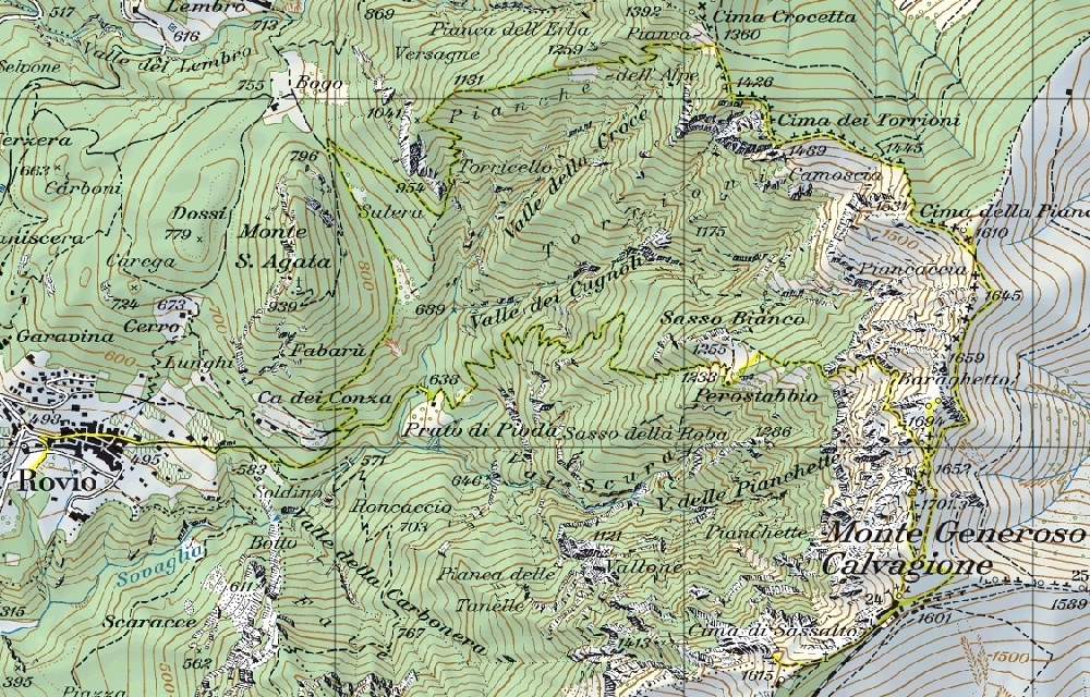
Map of the Path

Summits
Huts


Comments (0)