
Monte Lema
Information
| Date: | 9 November 2020 |
| Maximum height: | 1620 m |
| Difference in height: | 970 m |
| Length: | 12.5 km |
| Kilometers effort: | 25.4 kmef |
| Duration: | 5 hours |
| For the following peak, there are other variants of the ascent: | Monte Lema |
Difficulties (Automatic translation in english)

|
From Miglieglia up to the altitude of 1363 metres (T1 the road sections). |

|
From the altitude of 1363 metres to the top of Monte Lema and then down to Alpe Boscone. |
|
|
From Alpe Boscone to Miglieglia (T1 the road sections). |
Comment (Automatic translation in english)
Today, taking advantage of the closure of the cable car, I return to Monte Lema after many years.
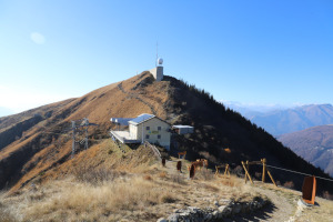
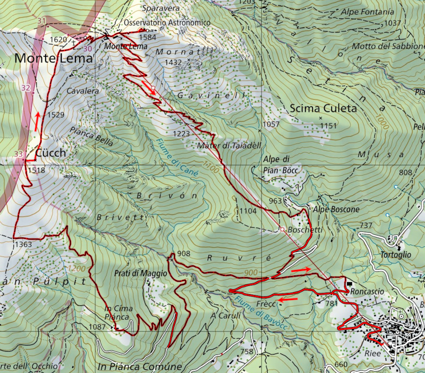
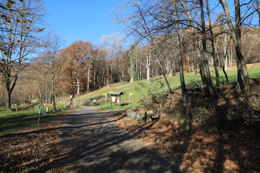
I left my car in Miglieglia, at the car park of the cable car, and started to walk up along the road (closed to traffic) to Roncascio. At the fork in the road at 781 metres above sea level, I continue to follow the road for about a hundred metres of difference in height, then I leave it to follow the path that heads west. After reaching the village of Cima Pianca I continue to climb up to the fork at an altitude of 1363 metres. At this point, after turning right, I climb up the slope to an altitude of 1,500 metres, where I briefly leave the path to climb to the summit of Cücch. I only discovered later that on the north side of the summit there is a small path that is easier to follow than the route I took. After this diversions I return to the main path and in a short time I reach the summit of Monte Lema where there is an enormous cross and a weather radar. In the midst of these two imposing structures you hardly even notice the real summit, marked by a simple boundary stone.
A few hundred metres from the summit there is also a restaurant and an astronomical observatory. Near the latter, an analemmatic sundial was built 8 years ago, which has the peculiarity, compared to the classical one, of having the gnomon (rod that casts the shadow) vertical. Because of this, the gnomon is not fixed but must be moved forward or backward depending on the month in which one is. In addition, if nothing else, the gnomon can also be created by a person standing on the dial itself.
For the return journey, I chose to follow the path that descends directly below the Monte Lema cable car. Compared to the one taken uphill, it is steeper but also more direct and shorter. However, it has the disadvantage of offering a panorama that is certainly more monotonous and less pleasant than the other.
Having passed Alpe Boscone, I continue up to an altitude of about 870 metres, where this time, in order to vary the itinerary a little, I take the path that descends directly to Roncascio. Once I have reached the crossroads again at 781 metres, I quickly return to Miglieglia along the same road I took on the way up.
Water (Automatic translation in english)
There is a fountain above Miglieglia at an altitude of around 766 metres and then another at Cima Pianca. On the way back, there is another one south of Alpe Boscone.
Map of the Path

Summits


Comments (1)
Grazie